world.wikisort.org - Austria
Mitterlabill is a former municipality in the district of Südoststeiermark in the Austrian state of Styria. Since the 2015 Styria municipal structural reform, it is part of the municipality Schwarzautal, in the Leibnitz District.[2]
Mitterlabill | |
|---|---|
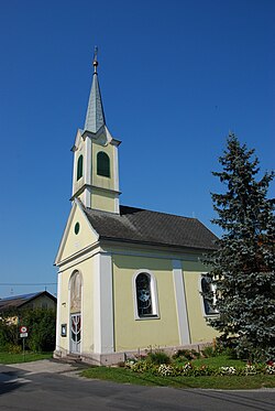
 Chapel in Mitterlabill | |
 Mitterlabill Location within Austria | |
| Coordinates: 46°53′00″N 15°38′00″E | |
| Country | Austria |
| State | Styria |
| District | Leibnitz |
| Government | |
| • Mayor | Adolf Totter (ÖVP) |
| Area | |
| • Total | 7.88 km2 (3.04 sq mi) |
| Elevation | 309 m (1,014 ft) |
| Population (1 January 2016)[1] | |
| • Total | 414 |
| • Density | 53/km2 (140/sq mi) |
| Time zone | UTC+1 (CET) |
| • Summer (DST) | UTC+2 (CEST) |
| Postal code | 8413 |
| Area code | +43 3184 |
| Vehicle registration | FB |
| Website | www.mitterlabill. steiermark.at |
Population
| Year | Pop. | ±% |
|---|---|---|
| 1869 | 514 | — |
| 1880 | 534 | +3.9% |
| 1890 | 511 | −4.3% |
| 1900 | 531 | +3.9% |
| 1910 | 489 | −7.9% |
| 1923 | 516 | +5.5% |
| 1934 | 474 | −8.1% |
| 1939 | 461 | −2.7% |
| 1951 | 449 | −2.6% |
| 1961 | 443 | −1.3% |
| 1971 | 443 | +0.0% |
| 1981 | 464 | +4.7% |
| 1991 | 456 | −1.7% |
| 2001 | 447 | −2.0% |
| 2013 | 399 | −10.7% |
References
На других языках
[de] Mitterlabill
Mitterlabill ist eine Ortschaft und eine Katastralgemeinde der Gemeinde Schwarzautal im Bezirk Leibnitz in der Steiermark.- [en] Mitterlabill
[ru] Миттерлабилль
Миттерлабилль (нем. Mitterlabill) — коммуна в Австрии, в федеральной земле Штирия.Текст в блоке "Читать" взят с сайта "Википедия" и доступен по лицензии Creative Commons Attribution-ShareAlike; в отдельных случаях могут действовать дополнительные условия.
Другой контент может иметь иную лицензию. Перед использованием материалов сайта WikiSort.org внимательно изучите правила лицензирования конкретных элементов наполнения сайта.
Другой контент может иметь иную лицензию. Перед использованием материалов сайта WikiSort.org внимательно изучите правила лицензирования конкретных элементов наполнения сайта.
2019-2025
WikiSort.org - проект по пересортировке и дополнению контента Википедии
WikiSort.org - проект по пересортировке и дополнению контента Википедии