world.wikisort.org - Australia
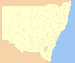
La città di Queanbeyan è una Local Government Area che si trova nel Nuovo Galles del Sud. Essa si estende su una superficie di 172 chilometri quadrati e ha una popolazione di 37.991 abitanti[1]. La sede del consiglio si trova a Queanbeyan.
| Città di Queanbeyan local government area | |
|---|---|
| Queanbeyan City Council | |
| Localizzazione | |
| Stato | |
| Stato federato | |
| Amministrazione | |
| Capoluogo | Queanbeyan |
| Territorio | |
| Coordinate del capoluogo | 35°21′S 149°13′E |
| Superficie | 172 km² |
| Abitanti | 37 991 (2011) |
| Densità | 220,88 ab./km² |
| Altre informazioni | |
| Fuso orario | UTC+10 |
| Codice ABS | LGA16470 |
| Cartografia | |
 | |
| Sito istituzionale | |

Note
- Censimento 2011 dal sito dell'Ufficio di Statistica australiano
Altri progetti
 Wikimedia Commons contiene immagini o altri file su città di Queanbeyan
Collegamenti esterni
- (EN) Sito ufficiale, su qcc.nsw.gov.au.
На других языках
[de] Queanbeyan City
-35.35149.23333333333 Die City of Queanbeyan war ein lokales Verwaltungsgebiet (LGA) im australischen Bundesstaat New South Wales. Das Gebiet war 172 km² groß und hatte etwa 38.000 Einwohner.[1] 2016 ging es im Queanbeyan-Palerang Regional Council auf.[en] City of Queanbeyan
Queanbeyan City was a local government area located in south eastern New South Wales, Australia. The former area is located adjacent to Canberra and the Australian Capital Territory, the Queanbeyan River, the Molonglo River, the Kings Highway and the Sydney-Canberra railway.- [it] Città di Queanbeyan
Текст в блоке "Читать" взят с сайта "Википедия" и доступен по лицензии Creative Commons Attribution-ShareAlike; в отдельных случаях могут действовать дополнительные условия.
Другой контент может иметь иную лицензию. Перед использованием материалов сайта WikiSort.org внимательно изучите правила лицензирования конкретных элементов наполнения сайта.
Другой контент может иметь иную лицензию. Перед использованием материалов сайта WikiSort.org внимательно изучите правила лицензирования конкретных элементов наполнения сайта.
2019-2026
WikiSort.org - проект по пересортировке и дополнению контента Википедии
WikiSort.org - проект по пересортировке и дополнению контента Википедии