world.wikisort.org - Australia

Search / Calendar

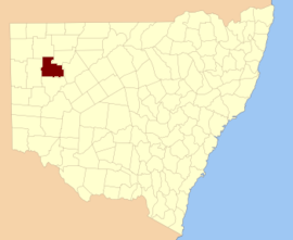
Yungnulgra County is one of the 141 Cadastral divisions of New South Wales.

Map all coordinates using: OpenStreetMap 
Download coordinates as: KML
Yungnulgra
New South Wales
Location in New South Wales
Lands administrative divisions around Yungnulgra:
Yantara Yantara Fitzgerald
Mootwingee Yungnulgra Killara
Mootwingee Young Killara

The name Yungnulgra is believed to be derived from a local Aboriginal word and is also the name used for Yungnulgra Plains.[1]


Parishes within this county


A full list of parishes found within this county; their current LGA and mapping coordinates to the approximate centre of each location is as follows:

ParishLGACoordinates
BeefwoodCentral Darling Shire31°08′44″S 143°13′23″E
CootawundyCentral Darling Shire31°09′40″S 142°42′45″E
CopeCentral Darling Shire30°47′04″S 142°49′25″E
DawesCentral Darling Shire31°10′31″S 142°47′53″E
DilkooshaCentral Darling Shire31°05′40″S 143°27′09″E
ElderCentral Darling Shire30°43′10″S 143°06′00″E
ErnooCentral Darling Shire30°32′51″S 142°56′15″E
GamboolCentral Darling Shire31°05′15″S 143°13′25″E
GermanoCentral Darling Shire31°03′44″S 142°49′28″E
GnaltaUnincorporated Far West Region31°11′05″S 142°37′36″E
GoorpookaCentral Darling Shire30°44′30″S 143°46′36″E
KandieUnincorporated Far West Region30°49′15″S 142°36′55″E
KerndombieCentral Darling Shire30°57′19″S 142°49′25″E
KernoCentral Darling Shire31°02′27″S 142°59′34″E
KirkCentral Darling Shire30°50′10″S 143°06′01″E
MallambrayCentral Darling Shire31°15′52″S 143°20′21″E
MenamurteeCentral Darling Shire31°04′22″S 143°10′00″E
MoonamurtieCentral Darling Shire31°05′40″S 143°20′23″E
MunroCentral Darling Shire30°59′34″S 143°13′26″E
Nulla NullaUnincorporated Far West Region30°49′24″S 142°32′00″E
PamparaUnincorporated Far West Region31°03′18″S 142°29′59″E
ParkungiCentral Darling Shire30°56′53″S 143°22′02″E
PulchraUnincorporated Far West Region30°29′56″S 142°45′54″E
QuambyUnincorporated Far West Region30°25′45″S 142°45′52″E
RosstrevorCentral Darling Shire30°52′08″S 143°14′45″E
RutherfordCentral Darling Shire30°41′18″S 143°32′01″E
TullyCentral Darling Shire30°36′35″S 142°52′52″E
UllollieCentral Darling Shire31°03′02″S 143°27′09″E
WalkerCentral Darling Shire31°09′26″S 142°52′33″E
WallaUnincorporated Far West Region30°41′11″S 142°41′19″E
WertagoUnincorporated Far West Region30°53′43″S 142°41′03″E
WilldrilliUnincorporated Far West Region30°38′00″S 142°33′13″E
WilliamsUnincorporated Far West Region30°44′59″S 142°41′53″E
Wirra WirraCentral Darling Shire31°01′25″S 143°07′19″E
WoraroUnincorporated Far West Region30°58′01″S 142°30′22″E
YancanniaUnincorporated Far West Region30°21′02″S 142°35′09″E
YeiltaraUnincorporated Far West Region30°29′59″S 142°35′07″E
YerndamboolCentral Darling Shire30°58′05″S 142°59′33″E
YowahrooCentral Darling Shire30°45′10″S 142°57′11″E

References


  1. "Yungnulgra". Geographical Names Register (GNR) of NSW. Geographical Names Board of New South Wales. Retrieved 30 July 2013.


Map all coordinates using: OpenStreetMap 
Download coordinates as: KML


Текст в блоке "Читать" взят с сайта "Википедия" и доступен по лицензии Creative Commons Attribution-ShareAlike; в отдельных случаях могут действовать дополнительные условия.

Другой контент может иметь иную лицензию. Перед использованием материалов сайта WikiSort.org внимательно изучите правила лицензирования конкретных элементов наполнения сайта.

2019-2025
WikiSort.org - проект по пересортировке и дополнению контента Википедии