world.wikisort.org - Australia
Waljeers County is one of the 141 Cadastral divisions of New South Wales. It contains the town of Booligal.
| Waljeers New South Wales | |||||||||||||||
|---|---|---|---|---|---|---|---|---|---|---|---|---|---|---|---|
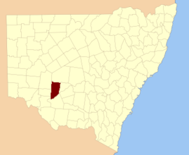 Location in New South Wales | |||||||||||||||
| |||||||||||||||
The name Waljeers is derived from a local Aboriginal word of the Muthi Muthi tribe.[1]
Lake Waljeers is one of largest lakes located north of the Lachlan River and the river crossing at Thellangering.

Parishes within this county
A full list of parishes found within this county; their current LGA and mapping coordinates to the approximate centre of each location is as follows:
| Parish | LGA | Coordinates |
|---|---|---|
| Abbotsford | Central Darling Shire | 33°13′50″S 144°19′26″E |
| Alma | Balranald Shire | 33°23′34″S 144°16′18″E |
| Annan | Carrathool Shire | 33°21′04″S 144°39′15″E |
| Arrawatta | Balranald Shire | 33°43′41″S 144°28′14″E |
| Avondale | Carrathool Shire | 33°24′02″S 144°25′43″E |
| Benanimie | Hay Shire | 33°51′50″S 144°49′35″E |
| Billabong | Carrathool Shire | 33°20′21″S 144°25′52″E |
| Boondara | Carrathool Shire | 33°17′23″S 144°39′13″E |
| Brassbutt | Balranald Shire | 34°07′21″S 144°23′39″E |
| Buckonyong | Balranald Shire | 34°06′37″S 144°09′18″E |
| Bulgarbugerygam | Balranald Shire | 33°42′33″S 144°14′07″E |
| Bullogal | Balranald Shire | 33°55′09″S 144°31′18″E |
| Bungarry | Balranald Shire | 34°03′30″S 144°17′00″E |
| Campbell | Carrathool Shire | 33°29′14″S 144°30′18″E |
| Carngham | Hay Shire | 33°32′02″S 144°37′36″E |
| Corrong | Balranald Shire | 34°09′20″S 144°29′39″E |
| Culparling | Balranald Shire | 33°30′33″S 144°15′37″E |
| Culpataro | Balranald Shire | 33°37′36″S 144°23′51″E |
| Dimboola | Balranald Shire | 33°57′34″S 144°28′54″E |
| Ellisland | Balranald Shire | 33°16′40″S 144°18′56″E |
| Goona Warra | Hay Shire | 33°59′57″S 144°39′07″E |
| Gregory | Balranald Shire | 33°56′28″S 144°10′41″E |
| Howatson | Carrathool Shire | 33°20′35″S 144°46′29″E |
| Kingswell | Hay Shire | 33°34′27″S 144°44′50″E |
| Lagan | Balranald Shire | 34°05′09″S 144°23′59″E |
| Largs | Carrathool Shire | 33°21′03″S 144°32′01″E |
| Larnaca | Hay Shire | 33°35′46″S 144°34′53″E |
| Lowan | Central Darling Shire | 33°14′09″S 144°29′03″E |
| Marowie | Balranald Shire | 33°52′18″S 144°26′53″E |
| Massie | Hay Shire | 33°42′56″S 144°44′18″E |
| Matamong | Balranald Shire | 34°03′36″S 144°29′21″E |
| Mekai | Carrathool Shire | 33°22′51″S 144°45′57″E |
| Merrimajeel | Hay Shire | 33°55′29″S 144°37′39″E |
| Moodarnong | Hay Shire | 33°49′29″S 144°48′57″E |
| Mossgiel | Central Darling Shire | 33°10′56″S 144°35′50″E |
| Mulloga | Balranald Shire | 34°06′02″S 144°16′36″E |
| Murnia | Carrathool Shire | 33°14′06″S 144°48′40″E |
| Murra | Hay Shire | 33°45′38″S 144°35′19″E |
| Nandum | Balranald Shire | 34°00′49″S 144°10′00″E |
| Natue | Hay Shire | 33°50′51″S 144°42′21″E |
| Nyanda | Hay Shire | 33°48′42″S 144°42′51″E |
| Pimpara | Balranald Shire | 34°11′48″S 144°22′20″E |
| Sebastopol | Balranald Shire | 33°46′04″S 144°22′30″E |
| Simson | Central Darling Shire | |
| St Andrew | Hay Shire | 33°33′06″S 144°30′50″E |
| Tarrawong | Balranald Shire | 33°52′40″S 144°13′16″E |
| Tartoo | Hay Shire | 33°41′16″S 144°38′32″E |
| Tinna | Hay Shire | 33°47′42″S 144°34′57″E |
| Toms Lake | Hay Shire | 33°38′17″S 144°45′04″E |
| Toopruck | Balranald Shire | 34°13′41″S 144°15′47″E |
| Tooralboung | Balranald Shire | 34°10′16″S 144°09′00″E |
| Trawalla | Central Darling Shire | 33°12′12″S 144°44′25″E |
| Tyson | Balranald Shire | 33°50′08″S 144°22′20″E |
| Waljeers | Balranald Shire | 34°03′10″S 144°36′27″E |
| Waverley | Carrathool Shire | 33°25′08″S 144°39′00″E |
| Wickham | Balranald Shire | 33°27′51″S 144°16′03″E |
| Willandra | Central Darling Shire | 33°09′18″S 144°20′11″E |
| Wyunga | Balranald Shire | 34°00′37″S 144°20′14″E |
| Yaloo | Hay Shire | 33°57′06″S 144°44′07″E |
| Yarto | Hay Shire | 33°27′26″S 144°45′58″E |
References
- "Waljeers". Geographical Names Register (GNR) of NSW. Geographical Names Board of New South Wales. Retrieved 11 August 2013.
Текст в блоке "Читать" взят с сайта "Википедия" и доступен по лицензии Creative Commons Attribution-ShareAlike; в отдельных случаях могут действовать дополнительные условия.
Другой контент может иметь иную лицензию. Перед использованием материалов сайта WikiSort.org внимательно изучите правила лицензирования конкретных элементов наполнения сайта.
Другой контент может иметь иную лицензию. Перед использованием материалов сайта WikiSort.org внимательно изучите правила лицензирования конкретных элементов наполнения сайта.
2019-2026
WikiSort.org - проект по пересортировке и дополнению контента Википедии
WikiSort.org - проект по пересортировке и дополнению контента Википедии