world.wikisort.org - Australia
Tabooba is a rural locality in the Scenic Rim Region, Queensland, Australia.[2] In the 2016 census, Tabooba had a population of 72 people.[1]
| Tabooba Queensland | |||||||||||||||
|---|---|---|---|---|---|---|---|---|---|---|---|---|---|---|---|
 Paddocks along Christmas Creek Road, 2014 | |||||||||||||||
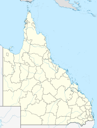  Tabooba | |||||||||||||||
| Coordinates | 28.1358°S 152.9669°E | ||||||||||||||
| Population | 72 (2016 census)[1] | ||||||||||||||
| • Density | 2.988/km2 (7.74/sq mi) | ||||||||||||||
| Postcode(s) | 4285 | ||||||||||||||
| Area | 24.1 km2 (9.3 sq mi) | ||||||||||||||
| Time zone | AEST (UTC+10:00) | ||||||||||||||
| Location |
| ||||||||||||||
| LGA(s) | Scenic Rim Region | ||||||||||||||
| State electorate(s) | Scenic Rim | ||||||||||||||
| Federal division(s) | Wright | ||||||||||||||
| |||||||||||||||
Geography
Tabooba is located at the confluence of Christmas Creek and Logan River. Logan River marks the western boundary. In the east the locality reaches elevations greater than 400 m above sea level, along Jinbroken Range.[citation needed]
History
The Beaudesert Shire Tramway passed through Tabooba and opened in 1902.[3] The station was known as Tabooba Junction. Here the line split with one branch reaching Rathdowney and the other to Lamington.[citation needed]
Tabooba State School opened on 24 July 1911 and closed on 24 August 1942.[4]
In the 2016 census, Tabooba had a population of 72 people.[1]
See also
- List of tramways in Queensland
References
- Australian Bureau of Statistics (27 June 2017). "Tabooba (SSC)". 2016 Census QuickStats. Retrieved 20 October 2018.
- "Tabooba – locality in Scenic Rim Region (entry 45189)". Queensland Place Names. Queensland Government. Retrieved 16 June 2020.
- "Beaudesert Shire Timeline". Scenic Rim Regional Council. Retrieved 3 September 2014.
- Queensland Family History Society (2010), Queensland schools past and present (Version 1.01 ed.), Queensland Family History Society, ISBN 978-1-921171-26-0

Текст в блоке "Читать" взят с сайта "Википедия" и доступен по лицензии Creative Commons Attribution-ShareAlike; в отдельных случаях могут действовать дополнительные условия.
Другой контент может иметь иную лицензию. Перед использованием материалов сайта WikiSort.org внимательно изучите правила лицензирования конкретных элементов наполнения сайта.
Другой контент может иметь иную лицензию. Перед использованием материалов сайта WikiSort.org внимательно изучите правила лицензирования конкретных элементов наполнения сайта.
2019-2026
WikiSort.org - проект по пересортировке и дополнению контента Википедии
WikiSort.org - проект по пересортировке и дополнению контента Википедии