world.wikisort.org - Australia
Sturt County is one of the 141 Cadastral divisions of New South Wales. It contains the locality of Carrathool. The Murrumbidgee River is the southern boundary.
| Sturt New South Wales | |||||||||||||||
|---|---|---|---|---|---|---|---|---|---|---|---|---|---|---|---|
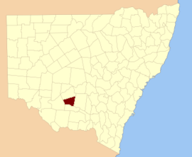 Location in New South Wales | |||||||||||||||
| |||||||||||||||

![Sturt County NSW as shown on John Sands 1886 map)[1]](http://upload.wikimedia.org/wikipedia/commons/thumb/a/a5/Sturt_Count_NSW_%28John_Sands_1886_map%29.png/220px-Sturt_Count_NSW_%28John_Sands_1886_map%29.png)
Sturt County was named in honour of the explorer, soldier and public servant Charles Sturt (1795-1869).[2]
Parishes within this county
A full list of parishes found within this county; their current LGA and mapping coordinates to the approximate centre of each location is as follows:
| Parish | LGA | Coordinates |
|---|---|---|
| Alleyne | Carrathool Shire Council | 34°18′54″S 145°28′04″E |
| Baillie | City of Griffith | 34°22′54″S 145°55′04″E |
| Ballingall | City of Griffith | 34°13′54″S 146°00′04″E |
| Beabula | Hay Shire Council | 34°13′54″S 145°11′04″E |
| Bendigo | City of Griffith | 34°21′54″S 145°47′04″E |
| Benerembah | Carrathool Shire Council | 34°28′54″S 145°55′04″E |
| Bringagee | Carrathool Shire Council | 34°25′54″S 145°45′04″E |
| Buckley | Carrathool Shire Council | 34°09′54″S 145°29′04″E |
| Cajaldura | Carrathool Shire Council | 34°23′54″S 145°34′04″E |
| Carrathool | Carrathool Shire Council | 34°22′54″S 145°30′04″E |
| Carrego | Carrathool Shire Council | 34°05′54″S 145°28′04″E |
| Cockburn | Carrathool Shire Council | 34°08′54″S 145°44′04″E |
| Denny | Carrathool Shire Council | 34°02′54″S 145°51′04″E |
| Djallah | City of Griffith | 34°23′54″S 145°51′04″E |
| Downey | Hay Shire Council | 34°11′54″S 145°09′04″E |
| Ercildoune | Carrathool Shire Council | 34°18′54″S 145°35′04″E |
| Hervey | Carrathool Shire Council | 34°10′54″S 145°42′04″E |
| Houlong | Carrathool Shire Council | 34°21′54″S 145°23′04″E |
| Hyde Park | Carrathool Shire Council | 34°18′54″S 145°41′04″E |
| Kooba | Carrathool Shire Council | 34°04′54″S 146°00′04″E |
| Kooroongal | Carrathool Shire Council | 34°23′54″S 145°40′04″E |
| Learmonth | City of Griffith | 34°15′54″S 145°48′04″E |
| Lethington | Carrathool Shire Council | 34°11′54″S 145°26′04″E |
| Livingstone | Carrathool Shire Council | 34°05′54″S 145°37′04″E |
| Maiden | Carrathool Shire Council | 34°02′54″S 145°43′04″E |
| Mair | Carrathool Shire Council | 34°10′54″S 145°37′04″E |
| Mills | Carrathool Shire Council | 34°07′54″S 145°19′04″E |
| Mirrool | City of Griffith | 34°08′54″S 146°02′04″E |
| Munro | Carrathool Shire Council | 34°02′54″S 145°55′04″E |
| North Bringagee | City of Griffith | 34°09′54″S 145°49′04″E |
| North Uardry | Carrathool Shire Council | 34°12′54″S 145°19′04″E |
| O'Brien | City of Griffith | 33°59′54″S 145°53′04″E |
| Quambatook | Carrathool Shire Council | 34°14′54″S 145°36′04″E |
| Tabbita | Carrathool Shire Council | 33°54′54″S 146°02′04″E |
| Tabbita | Carrathool Shire Council | 33°56′54″S 145°57′04″E |
| Terrapee | Carrathool Shire Council | 34°13′54″S 145°31′04″E |
| Toms Point | Carrathool Shire Council | 34°29′54″S 145°14′04″E |
| Uardry | Carrathool Shire Council | 34°20′54″S 145°18′04″E |
| Warburn | City of Griffith | 34°16′54″S 145°53′04″E |
| Wiveon | Carrathool Shire Council | 34°14′54″S 145°42′04″E |
| Wowong | Carrathool Shire Council | 34°28′54″S 145°50′04″E |
| Wycheproof | Carrathool Shire Council | 34°04′54″S 145°32′04″E |
| Yannaway | Carrathool Shire Council | 34°13′54″S 145°25′04″E |
References
- The New atlas of Australia (John Sands 1886) map 21.
- "Sturt County". Geographical Names Register (GNR) of NSW. Geographical Names Board of New South Wales.
Текст в блоке "Читать" взят с сайта "Википедия" и доступен по лицензии Creative Commons Attribution-ShareAlike; в отдельных случаях могут действовать дополнительные условия.
Другой контент может иметь иную лицензию. Перед использованием материалов сайта WikiSort.org внимательно изучите правила лицензирования конкретных элементов наполнения сайта.
Другой контент может иметь иную лицензию. Перед использованием материалов сайта WikiSort.org внимательно изучите правила лицензирования конкретных элементов наполнения сайта.
2019-2026
WikiSort.org - проект по пересортировке и дополнению контента Википедии
WikiSort.org - проект по пересортировке и дополнению контента Википедии