world.wikisort.org - Australia
Mouramba County is one of the 141 Cadastral divisions of New South Wales.
| Mouramba New South Wales | |||||||||||||||
|---|---|---|---|---|---|---|---|---|---|---|---|---|---|---|---|
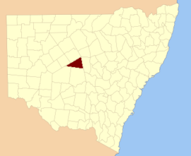 Location in New South Wales | |||||||||||||||
| |||||||||||||||
![Map of Mouramba County (New South Wales) in 1886.[1]](http://upload.wikimedia.org/wikipedia/commons/thumb/3/36/Mouramba_County_1886.png/220px-Mouramba_County_1886.png)
Mouramba is believed to be derived from a local Aboriginal word and is the name of nearby Mouramba Station.[2]
Parishes within this county
The parishes in the county, and mapping coordinates to the approximate centre of each, are:[citation needed]
All are in Cobar Shire.
References
- from John Sands, Atlas of Australia 1886.
- "Mouramba County". Geographical Names Register (GNR) of NSW. Geographical Names Board of New South Wales.
Текст в блоке "Читать" взят с сайта "Википедия" и доступен по лицензии Creative Commons Attribution-ShareAlike; в отдельных случаях могут действовать дополнительные условия.
Другой контент может иметь иную лицензию. Перед использованием материалов сайта WikiSort.org внимательно изучите правила лицензирования конкретных элементов наполнения сайта.
Другой контент может иметь иную лицензию. Перед использованием материалов сайта WikiSort.org внимательно изучите правила лицензирования конкретных элементов наполнения сайта.
2019-2026
WikiSort.org - проект по пересортировке и дополнению контента Википедии
WikiSort.org - проект по пересортировке и дополнению контента Википедии