world.wikisort.org - Australia
Molangul is a rural locality in the Bundaberg Region, Queensland, Australia.[2] In the 2016 census, Molangul had a population of 13 people.[1]
| Molangul Queensland | |||||||||||||||
|---|---|---|---|---|---|---|---|---|---|---|---|---|---|---|---|
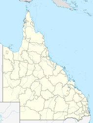  Molangul | |||||||||||||||
| Coordinates | 24.7672°S 151.5386°E | ||||||||||||||
| Population | 13 (2016 census)[1] | ||||||||||||||
| • Density | 0.0699/km2 (0.181/sq mi) | ||||||||||||||
| Postcode(s) | 4671 | ||||||||||||||
| Area | 185.9 km2 (71.8 sq mi) | ||||||||||||||
| Time zone | AEST (UTC+10:00) | ||||||||||||||
| LGA(s) | Bundaberg Region | ||||||||||||||
| State electorate(s) | Callide | ||||||||||||||
| Federal division(s) | Flynn | ||||||||||||||
| |||||||||||||||
Geography
The Kalpowar Road passes through the locality from Gaeta to the south-east through to Kalpowar to the west.[3]
History
In 1887, 72,080 acres (29,170 ha) of land were resumed from the Molungal pastoral run. The land was offered for selection for the establishment of small farms on 17 April 1887.[4]
In the 2016 census, Molangul had a population of 13 people.[1]
Education
There are no schools in Molangul. The nearest primary schools are in Builyan and Mount Perry. The nearest secondary school is in Monto.[3]
References
- Australian Bureau of Statistics (27 June 2017). "Molangul (SSC)". 2016 Census QuickStats. Retrieved 20 October 2018.
- "Molangul – locality in Bundaberg Region (entry 44745)". Queensland Place Names. Queensland Government. Retrieved 26 January 2020.
- "Queensland Globe". State of Queensland. Retrieved 21 February 2020.
- "Proclamations under the New Land Acts". The Brisbane Courier. Queensland, Australia. 2 March 1877. p. 3. Retrieved 20 February 2020 – via Trove.

Текст в блоке "Читать" взят с сайта "Википедия" и доступен по лицензии Creative Commons Attribution-ShareAlike; в отдельных случаях могут действовать дополнительные условия.
Другой контент может иметь иную лицензию. Перед использованием материалов сайта WikiSort.org внимательно изучите правила лицензирования конкретных элементов наполнения сайта.
Другой контент может иметь иную лицензию. Перед использованием материалов сайта WikiSort.org внимательно изучите правила лицензирования конкретных элементов наполнения сайта.
2019-2026
WikiSort.org - проект по пересортировке и дополнению контента Википедии
WikiSort.org - проект по пересортировке и дополнению контента Википедии