world.wikisort.org - Australia
Mitchell County is one of the 141 Cadastral divisions of New South Wales. It contains the town of Collingullie. The Murrumbidgee River is the northern boundary.
| Mitchell New South Wales | |||||||||||||||
|---|---|---|---|---|---|---|---|---|---|---|---|---|---|---|---|
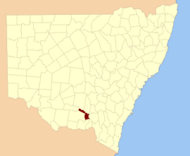 Location in New South Wales | |||||||||||||||
| |||||||||||||||
Mitchell County is named in honour of the Surveyor-General Sir Thomas Livingstone Mitchell (1792-1855).[1]
Parishes within this county
A full list of parishes found within this county; their current LGA and mapping coordinates to the approximate centre of each location is as follows:
| Parish | LGA | Coordinates |
|---|---|---|
| Arajoel | City of Wagga Wagga | 35°01′54″S 146°50′04″E |
| Ashcroft | Lockhart Shire Council | 35°13′54″S 146°53′04″E |
| Berry Jerry | City of Wagga Wagga | 35°02′54″S 147°00′04″E |
| Birrego | Narrandera Shire Council | 34°56′54″S 146°35′04″E |
| Brewarrina | Narrandera Shire Council | 34°51′54″S 146°45′04″E |
| Buckinbong | Narrandera Shire Council | 34°51′54″S 146°41′04″E |
| Bulgary | City of Wagga Wagga | 35°00′54″S 146°57′04″E |
| Bullenbung | Lockhart Shire Council | 35°07′54″S 147°00′04″E |
| Burke | Lockhart Shire Council | 35°17′54″S 147°10′04″E |
| Burrandana | City of Wagga Wagga | 35°23′54″S 147°22′04″E |
| Coffin Rock | City of Wagga Wagga | 35°21′54″S 147°18′04″E |
| Corobimilla | Narrandera Shire Council | 34°52′54″S 146°23′04″E |
| Cox | Lockhart Shire Council | 35°22′54″S 147°08′04″E |
| Cuddell | Narrandera Shire Council | 34°48′54″S 146°24′04″E |
| Edgehill | Lockhart Shire Council | 35°28′54″S 147°01′04″E |
| Faithfull | Narrandera Shire Council | 34°57′54″S 146°41′04″E |
| Gillenbah | Narrandera Shire Council | 34°44′54″S 146°30′04″E |
| Gobbagaula | Narrandera Shire Council | 34°51′54″S 146°36′04″E |
| Grubben | Lockhart Shire Council | 35°24′54″S 147°00′04″E |
| Hanging Rock | Lockhart Shire Council | 35°15′54″S 147°03′04″E |
| Leitch | Lockhart Shire Council | 35°14′54″S 147°07′04″E |
| Maclean | City of Wagga Wagga | 35°26′54″S 147°15′04″E |
| Mangoplah | City of Wagga Wagga | 35°22′54″S 147°15′04″E |
| Milbrulong | Lockhart Shire Council | 35°18′54″S 146°55′04″E |
| Mimosa | Narrandera Shire Council | 35°00′54″S 146°46′04″E |
| Mundawaddery | Lockhart Shire Council | 35°23′54″S 146°53′04″E |
| Mundowy | City of Wagga Wagga | 35°06′54″S 147°06′04″E |
| Osborne | City of Wagga Wagga | 35°07′54″S 146°54′04″E |
| Pearson | City of Wagga Wagga | 35°15′54″S 147°11′04″E |
| Pulletop | City of Wagga Wagga | 35°26′54″S 147°22′04″E |
| Sandy Creek | City of Wagga Wagga | 35°15′54″S 147°18′04″E |
| Tootool | Lockhart Shire Council | 35°14′54″S 147°00′04″E |
| Uranquinty | City of Wagga Wagga | 35°06′54″S 147°15′04″E |
| Vincent | Lockhart Shire Council | 35°20′54″S 147°00′04″E |
| Wauberrima | City of Wagga Wagga | 34°56′54″S 146°51′04″E |
| Westby | City of Wagga Wagga | 35°26′54″S 147°27′04″E |
| Wood | Narrandera Shire Council | 34°52′54″S 146°30′04″E |
| Yarabee | Narrandera Shire Council | 34°44′54″S 146°26′04″E |
| Yarragundry | City of Wagga Wagga | 35°08′54″S 147°12′04″E |
| Yerong | Lockhart Shire Council | 35°24′54″S 147°05′04″E |
References
- "Mitchell County". Geographical Names Register (GNR) of NSW. Geographical Names Board of New South Wales.
На других языках
- [en] Mitchell County, New South Wales
[ru] Митчелл (округ, Новый Южный Уэльс)
Округ Митчелл (англ. Mitchell County) является одним из 141 округов административного деления Нового Южного Уэльса[en] (Австралия). В нём находится город Калингали[en]. Северная граница проходит по реке Маррамбиджи.Текст в блоке "Читать" взят с сайта "Википедия" и доступен по лицензии Creative Commons Attribution-ShareAlike; в отдельных случаях могут действовать дополнительные условия.
Другой контент может иметь иную лицензию. Перед использованием материалов сайта WikiSort.org внимательно изучите правила лицензирования конкретных элементов наполнения сайта.
Другой контент может иметь иную лицензию. Перед использованием материалов сайта WikiSort.org внимательно изучите правила лицензирования конкретных элементов наполнения сайта.
2019-2025
WikiSort.org - проект по пересортировке и дополнению контента Википедии
WikiSort.org - проект по пересортировке и дополнению контента Википедии