world.wikisort.org - Australia
Malbon is a town in the locality of Kuridala in the Shire of Cloncurry, Queensland, Australia.[1]
| Malbon Kuridala, Queensland | |
|---|---|
 Streetscape, Malbon, circa 1940 | |
 Malbon | |
| Coordinates | 21.0741°S 140.3013°E |
| Postcode(s) | 4824 |
| Time zone | AEST (UTC+10:00) |
| Location |
|
| LGA(s) | Shire of Cloncurry |
| State electorate(s) | Traeger |
| Federal division(s) | Kennedy |
History
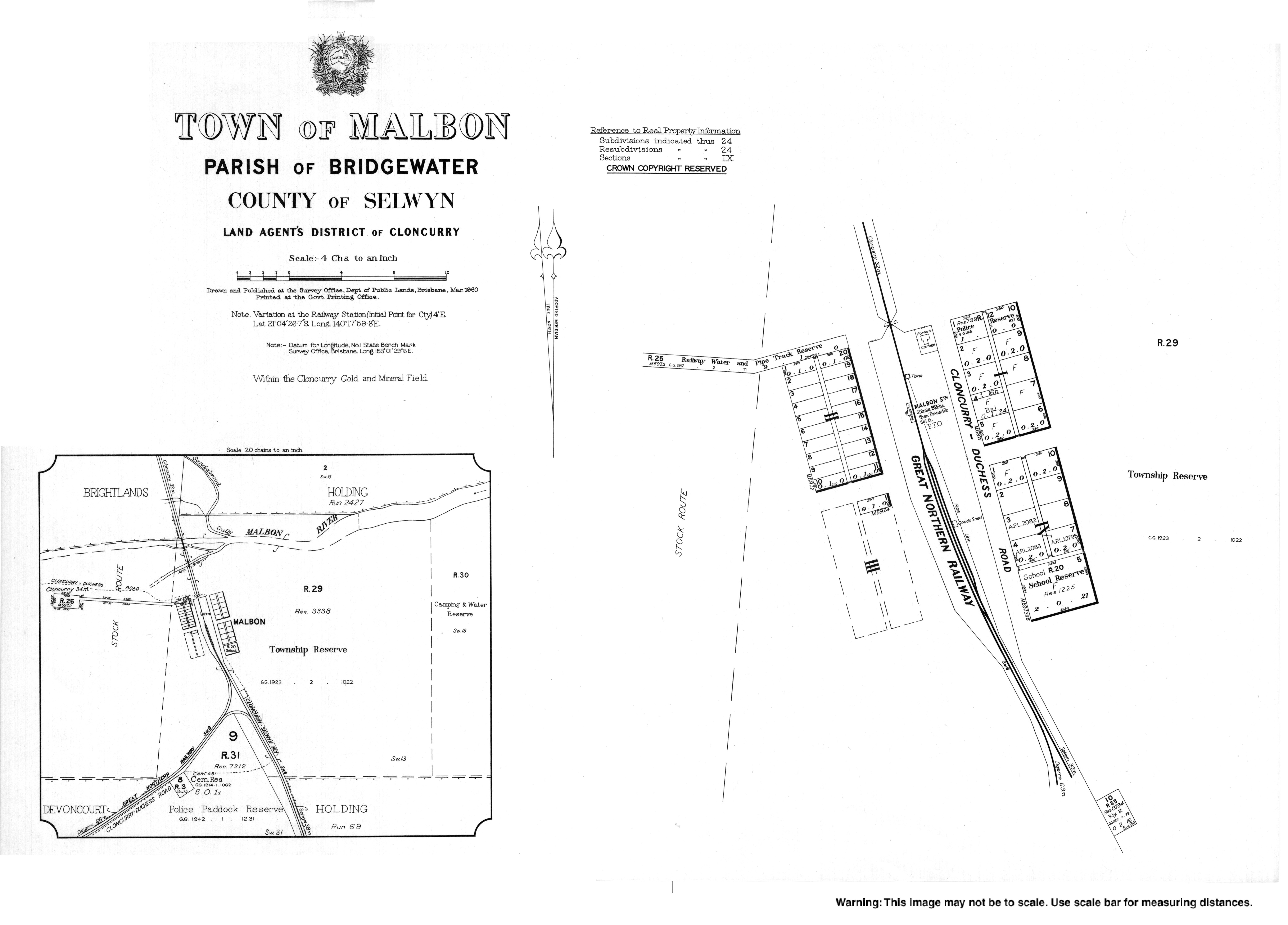
The Town of Malbon is shown on a 1910 survey plan.[1]
Malbon Provisional School opened on 7 November 1911. It became Malbon State School on 1 June 1916. It closed on 8 August 1969.[2] The school was located at the southern end of town on the Malbon Selwyn Road (21.0754°S 140.3019°E).[3]
References
- "Malbon – town in Shire of Cloncurry (entry 20691)". Queensland Place Names. Queensland Government. Retrieved 1 January 2018.
- Queensland Family History Society (2010), Queensland schools past and present (Version 1.01 ed.), Queensland Family History Society, ISBN 978-1-921171-26-0
- "Town map of Malbon". Queensland Government. 1960. Archived from the original on 6 January 2018. Retrieved 6 January 2018.
External links
Wikimedia Commons has media related to Malbon, Queensland.
- "Town map of Malbon". Queensland Government. 1960.
Текст в блоке "Читать" взят с сайта "Википедия" и доступен по лицензии Creative Commons Attribution-ShareAlike; в отдельных случаях могут действовать дополнительные условия.
Другой контент может иметь иную лицензию. Перед использованием материалов сайта WikiSort.org внимательно изучите правила лицензирования конкретных элементов наполнения сайта.
Другой контент может иметь иную лицензию. Перед использованием материалов сайта WikiSort.org внимательно изучите правила лицензирования конкретных элементов наполнения сайта.
2019-2026
WikiSort.org - проект по пересортировке и дополнению контента Википедии
WikiSort.org - проект по пересортировке и дополнению контента Википедии