world.wikisort.org - Australia
Lightsview is a suburb in the City of Port Adelaide Enfield. It was created in April 2016 from parts of Northgate, Greenacres and Northfield.[2] It is in the inner northeast, bounded by Hampstead Road, Redward Avenue, Fosters Road and Folland Avenue.[4]
| Lightsview Adelaide, South Australia | |||||||||||||||
|---|---|---|---|---|---|---|---|---|---|---|---|---|---|---|---|
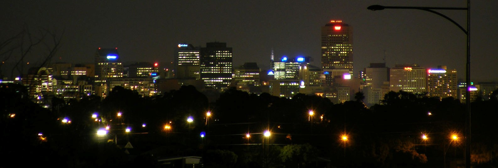 The Adelaide skyline at night from Lightsview and Northgate | |||||||||||||||
 Lightsview | |||||||||||||||
| Coordinates | 34°51′48″S 138°37′33″E[1] | ||||||||||||||
| Population | No data (2016 census)[1][lower-alpha 1] | ||||||||||||||
| Established | 7 April 2016[2][3] | ||||||||||||||
| Postcode(s) | 5085 | ||||||||||||||
| LGA(s) | City of Port Adelaide Enfield | ||||||||||||||
| State electorate(s) | Enfield | ||||||||||||||
| Federal division(s) | Adelaide | ||||||||||||||
| |||||||||||||||
| Footnotes | Adjoining suburbs[1] | ||||||||||||||
The bulk of the suburb of Lightsview began as a housing development (also named Lightsview) in the southern part of what was then the suburb of Northgate in 2006. The project was extended in October 2013 with the addition of the land from the former Ross Smith Secondary School.[5]
The suburb includes a row of houses along the north side of Redward Avenue that had previously been in Greenacres and are older than the main development. It also includes land fronting Hampstead Road that had been in Northfield including the former high school site and the Hampstead Rehabilitation Centre (a campus of the Royal Adelaide Hospital).
References
Notes
- For the 2016 census, people living within the suburb of Lightsview were counted either as part of the adjoining suburbs of Greenacres. Northfield or Northgate.[1]
Citations
- "Search results for 'Lightsview, SUB' with the following datasets being selected – 'Suburbs and Localities', 'Counties', 'Local Government Areas','Postcodes', 'SA Government Regions' and 'Gazetteer'". Location SA Map Viewer. Government of South Australia. Retrieved 4 August 2019.
- Stephen Mullighan (7 April 2016). "Geographical Names Act 1991 - Notice to Alter the Boundaries of Places and Assign a Name and Boundary to a Place" (PDF). Government Gazette. Government of South Australia. p. 1119 (PDF page 7). Retrieved 30 April 2016.
- New Suburb of Lightsview (PDF) (Map). Government of South Australia. Retrieved 30 April 2016.
- Councillor Mark Bassham (7 April 2016). "Lightsview Renaming". Retrieved 30 April 2016.
- "Lightsview". Renewal SA. Retrieved 2 May 2016.
External links
- www
.lightsview Housing development partnership between CIC Australia and RenewalSA (Government of South Australia).com .au
Другой контент может иметь иную лицензию. Перед использованием материалов сайта WikiSort.org внимательно изучите правила лицензирования конкретных элементов наполнения сайта.
WikiSort.org - проект по пересортировке и дополнению контента Википедии