world.wikisort.org - Australia
Gough County is one of the 141 Cadastral divisions of New South Wales.
| Gough New South Wales | |||||||||||||||
|---|---|---|---|---|---|---|---|---|---|---|---|---|---|---|---|
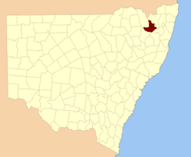 Location in New South Wales | |||||||||||||||
| |||||||||||||||
Gough County was named in honour of Field Marshal Sir Hugh Gough, first Viscount Gough (1779-1869).[1]
Parishes
A full list of parishes found within this county; their current LGA and mapping coordinates to the approximate centre of each location is as follows:
| Parish | LGA | Coordinates |
|---|---|---|
| Anderson | Inverell Shire | 29°48′54″S 151°18′04″E |
| Arvid | Glen Innes Severn Council | 29°21′54″S 151°29′04″E |
| Auburn Vale | Inverell Shire | 29°44′54″S 151°01′34″E |
| Balaclava | Inverell Shire | 29°47′54″S 151°31′04″E |
| Bald Nob | Glen Innes Severn Council | 29°40′54″S 151°58′04″E |
| Beardy Plains | Glen Innes Severn Council | 29°42′54″S 151°49′04″E |
| Ben Lomond | Armidale Regional Council | 29°59′54″S 151°41′04″E |
| Blair Hill | Glen Innes Severn Council | 29°50′54″S 151°52′04″E |
| Boyd | Glen Innes Severn Council | 29°36′54″S 151°49′04″E |
| Bundar | Glen Innes Severn Council | 29°22′54″S 151°37′04″E |
| Campbell | Inverell Shire | 29°41′54″S 151°12′04″E |
| Clifton | Glen Innes Severn Council | 29°48′54″S 151°40′04″E |
| Clive | Inverell Shire | 29°50′54″S 151°08′04″E |
| Deepwater | Glen Innes Severn Council | 29°29′54″S 151°52′04″E |
| Diehard | Glen Innes Severn Council | 29°40′54″S 152°03′04″E |
| Ditmas | Glen Innes Severn Council | 29°41′54″S 151°39′04″E |
| Dumaresq | Tenterfield Shire | 29°11′54″S 151°24′04″E |
| Eden | Inverell Shire | 29°51′54″S 151°21′04″E |
| Elsmore | Inverell Shire | 29°48′54″S 151°12′04″E |
| Fladbury | Glen Innes Severn Council | 29°31′54″S 151°38′04″E |
| Flagstone | Tenterfield Shire | 29°13′54″S 151°33′04″E |
| Fletcher | Glen Innes Severn Council | 29°51′54″S 151°42′04″E |
| Glen Innes | Glen Innes Severn Council | 29°43′54″S 151°46′04″E |
| Gordon | Glen Innes Severn Council | 29°33′54″S 151°32′04″E |
| Hamilton | Glen Innes Severn Council | 29°25′54″S 151°33′04″E |
| Herbert | Inverell Shire | 29°50′54″S 151°14′04″E |
| Highland Home | Tenterfield Shire | 29°18′54″S 151°41′04″E |
| Kingsgate | Glen Innes Severn Council | 29°45′54″S 151°58′04″E |
| Lands End | Glen Innes Severn Council | 29°16′54″S 151°29′04″E |
| Llangothlin | Glen Innes Severn Council | 29°59′54″S 151°41′04″E |
| Louis | Glen Innes Severn Council | 29°34′54″S 151°46′04″E |
| Macintyre | Inverell Shire | 29°56′54″S 151°35′04″E |
| Mann | Glen Innes Severn Council | 29°42′54″S 152°06′04″E |
| Marowan | Glen Innes Severn Council | 29°51′54″S 151°48′04″E |
| Mitchell | Glen Innes Severn Council | 29°41′54″S 151°55′04″E |
| Mount Mitchell | Glen Innes Severn Council | 29°59′54″S 151°48′04″E |
| Muir | Tenterfield Shire | 29°15′54″S 151°27′04″E |
| Newstead | Inverell Shire | 29°49′54″S 151°23′04″E |
| Paradise | Inverell Shire | 29°54′54″S 151°31′04″E |
| Paradise North | Glen Innes Severn Council | 29°18′54″S 151°34′59″E |
| Parkes | Glen Innes Severn Council | 29°27′54″S 151°58′04″E |
| Rangers Valley | Glen Innes Severn Council | 29°32′54″S 151°47′04″E |
| Robertson | Glen Innes Severn Council | 29°40′54″S 152°09′04″E |
| Ross | Inverell Shire | 29°43′54″S 151°27′04″E |
| Rusden | Glen Innes Severn Council | 29°43′54″S 151°53′04″E |
| Scone | Glen Innes Severn Council | 29°29′54″S 151°36′04″E |
| Scott | Glen Innes Severn Council | 29°31′54″S 152°01′04″E |
| Severn | Glen Innes Severn Council | 29°33′54″S 151°51′04″E |
| Stonehenge | Glen Innes Severn Council | 29°48′54″S 151°43′04″E |
| Strachan | Glen Innes Severn Council | 29°22′54″S 151°42′04″E |
| Strathbogie | Glen Innes Severn Council | 29°29′54″S 151°31′04″E |
| Strathbogie North | Glen Innes Severn Council | 29°23′54″S 151°34′04″E |
| Swanbrook | Inverell Shire | 29°42′54″S 151°17′04″E |
| Swanvale | Inverell Shire | 29°43′54″S 151°22′04″E |
| Tent Hill | Glen Innes Severn Council | 29°25′46″S 151°40′08″E |
| The Brothers | Glen Innes Severn Council | 29°46′54″S 152°05′04″E |
| Waterloo | Glen Innes Severn Council | 29°43′54″S 151°35′04″E |
| Wellingrove | Glen Innes Severn Council | 29°36′54″S 151°34′04″E |
| Wellington | Glen Innes Severn Council | 29°35′54″S 151°39′04″E |
| Wellington North | Tenterfield Shire | 29°17′54″S 151°39′04″E |
| Wellington Vale | Glen Innes Severn Council | 29°23′54″S 151°46′04″E |
| Yarrow | Glen Innes Severn Council | 29°52′54″S 152°00′04″E |
| Yarrowford | Glen Innes Severn Council | 29°36′54″S 151°46′04″E |
References
- "Gough". Geographical Names Register (GNR) of NSW. Geographical Names Board of New South Wales. Retrieved 3 August 2013.
Текст в блоке "Читать" взят с сайта "Википедия" и доступен по лицензии Creative Commons Attribution-ShareAlike; в отдельных случаях могут действовать дополнительные условия.
Другой контент может иметь иную лицензию. Перед использованием материалов сайта WikiSort.org внимательно изучите правила лицензирования конкретных элементов наполнения сайта.
Другой контент может иметь иную лицензию. Перед использованием материалов сайта WikiSort.org внимательно изучите правила лицензирования конкретных элементов наполнения сайта.
2019-2026
WikiSort.org - проект по пересортировке и дополнению контента Википедии
WikiSort.org - проект по пересортировке и дополнению контента Википедии