world.wikisort.org - Australia
Drake County is one of the 141 Cadastral divisions of New South Wales.
| Drake New South Wales | |||||||||||||||
|---|---|---|---|---|---|---|---|---|---|---|---|---|---|---|---|
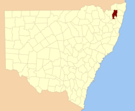 Location in New South Wales | |||||||||||||||
| |||||||||||||||
Drake County was named in honour of Sir Francis Drake (1540–1596).[1] It is located to the north of parts of the Clarence River, Nymboida River and Mann River. It includes the Washpool National Park.
Parishes within this county
A full list of parishes found within this county; their current LGA and mapping coordinates to the approximate centre of each location is as follows:
| Parish | LGA | Coordinates |
|---|---|---|
| Albert | Glen Innes Severn Council | 29°23′54″S 152°21′04″E |
| Alice | Clarence Valley Council | 29°02′54″S 152°38′04″E |
| Black Camp | Kyogle Council | 28°48′54″S 152°43′04″E |
| Cangai | Clarence Valley Council | 29°36′54″S 152°30′04″E |
| Carnham | Clarence Valley Council | 29°16′54″S 152°30′04″E |
| Chauvel | Tenterfield Shire Council | 28°55′54″S 152°32′04″E |
| Churchill | Clarence Valley Council | 29°10′54″S 152°30′04″E |
| Coombadjha | Clarence Valley Council | 29°22′54″S 152°28′04″E |
| Coongbar | Clarence Valley Council | 29°04′54″S 152°42′04″E |
| Cooraldooral | Glen Innes Severn Council | 29°34′54″S 152°16′04″E |
| Dandahra | Clarence Valley Council | 29°29′54″S 152°26′04″E |
| Drake | Tenterfield Shire Council | 29°00′54″S 152°25′04″E |
| Dunbar | Tenterfield Shire Council | 28°57′54″S 152°31′04″E |
| Ewingar | Clarence Valley Council | 29°05′54″S 152°30′04″E |
| Fairfield | Tenterfield Shire Council | 28°54′54″S 152°27′04″E |
| Hamilton | Tenterfield Shire Council | 29°01′54″S 152°30′04″E |
| Hassan | Clarence Valley Council | 29°20′54″S 152°45′04″E |
| Hongkong | Tenterfield Shire Council | 29°06′54″S 152°24′04″E |
| Keybarbin | Clarence Valley Council | 29°06′54″S 152°38′04″E |
| Malara | Tenterfield Shire Council | 29°12′54″S 152°22′04″E |
| Mookima | Clarence Valley Council | 29°14′54″S 152°43′04″E |
| Neville | Clarence Valley Council | 29°15′54″S 152°46′04″E |
| Ogilvie | Clarence Valley Council | 29°11′54″S 152°38′04″E |
| Picarbin | Kyogle Council | 28°57′54″S 152°36′04″E |
| Pikapene | Kyogle Council | 28°58′54″S 152°42′04″E |
| Plevna | Clarence Valley Council | 29°17′54″S 152°22′04″E |
| Pucka | Clarence Valley Council | 29°20′54″S 152°35′04″E |
| Puhoi | Clarence Valley Council | 29°35′54″S 152°24′04″E |
| Pulganbar | Clarence Valley Council | 29°26′54″S 152°41′04″E |
| Richmond | Glen Innes Severn Council | 29°29′54″S 152°21′04″E |
| Rodgers | Glen Innes Severn Council | 29°38′54″S 152°14′04″E |
| Rodham | Clarence Valley Council | 29°09′54″S 152°43′04″E |
| Sandilands | Kyogle Council | 28°54′54″S 152°42′04″E |
| Sistova | Tenterfield Shire Council | 29°13′54″S 152°16′04″E |
| Tabulam | Kyogle Council | 28°52′54″S 152°37′04″E |
| Timbarra | Tenterfield Shire Council | 28°52′54″S 152°30′04″E |
| West Fairfield | Tenterfield Shire Council | 28°55′54″S 152°22′04″E |
| Yarrcalkiarra | Clarence Valley Council | 29°16′54″S 152°39′04″E |
| Yulgilbar | Clarence Valley Council | 29°16′54″S 152°34′04″E |
References
- "Drake". Geographical Names Register (GNR) of NSW. Geographical Names Board of New South Wales. Retrieved 4 August 2013.
Текст в блоке "Читать" взят с сайта "Википедия" и доступен по лицензии Creative Commons Attribution-ShareAlike; в отдельных случаях могут действовать дополнительные условия.
Другой контент может иметь иную лицензию. Перед использованием материалов сайта WikiSort.org внимательно изучите правила лицензирования конкретных элементов наполнения сайта.
Другой контент может иметь иную лицензию. Перед использованием материалов сайта WikiSort.org внимательно изучите правила лицензирования конкретных элементов наполнения сайта.
2019-2026
WikiSort.org - проект по пересортировке и дополнению контента Википедии
WikiSort.org - проект по пересортировке и дополнению контента Википедии