world.wikisort.org - Australia
Dodges Ferry is a rural / residential locality in the local government area (LGA) of Sorell in the South-east LGA region of Tasmania. The locality is about 13 kilometres (8.1 mi) south-east of the town of Sorell. The 2016 census recorded a population of 2467 for the state suburb of Dodges Ferry.[1]
| Dodges Ferry Tasmania | |||||||||||||||
|---|---|---|---|---|---|---|---|---|---|---|---|---|---|---|---|
 Dodges Ferry | |||||||||||||||
| Coordinates | 42°51′S 147°37′E | ||||||||||||||
| Population | 2,467 (2016 census)[1] | ||||||||||||||
| Postcode(s) | 7173 | ||||||||||||||
| Location |
| ||||||||||||||
| LGA(s) | Sorell Council | ||||||||||||||
| Region | South-east | ||||||||||||||
| State electorate(s) | Lyons | ||||||||||||||
| Federal division(s) | Lyons | ||||||||||||||
| |||||||||||||||
History
Dodges Ferry was gazetted as a locality in 1966.[2]
Located on the eastern side of the entrance to Pittwater estuary it was named after Ralph Dodge (1791-1871) who operated a ferry service across Pittwater from the 1820s.
Dodges Ferry has long been a popular holiday area for Tasmanians with a focus on water activities. With its reputation for beautiful beaches (Frederick Henry Bay,Tiger Head Beach, Red Ochre Beach, Carlton Beach, Okines Beach), safe swimming areas, fishing, boating and a popular surf beach Park beach, people flock to the area on warmer days.
Since the 1960s Dodges Ferry has had a steady influx of permanent residents, changing from a holiday shack town to a residential town with newer facilities. At the 2016 census, Dodges Ferry had a population of 2,467.[3]
Geography
The waters of Frederick Henry Bay form the western to southern boundaries.[4]
Road infrastructure
Route C334 (Old Forcett Road / Carlton River Road) runs through from north-west to east.[2][5]

Gallery
 Okines beach
 Okines beach water spray
 Okines Beach
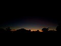 Night falling in Dodges Ferry
 Foggy days on Okines Beach


See also
- Dodges Ferry Football Club
- Sorell Council
References
- "2016 Census Quick Stats Dodges Ferry (Tas.)". quickstats.censusdata.abs.gov.au. Australian Bureau of Statistics. 23 October 2017. Retrieved 2 April 2021.
- "Placenames Tasmania – Dodges Ferry". Placenames Tasmania. Select “Search”, enter "13C", click “Search”, select row, map is displayed, click “Details”. Retrieved 2 April 2021.
- Australian Bureau of Statistics (27 June 2017). "Dodges Ferry (State Suburb)". 2016 Census QuickStats. Retrieved 5 April 2018.
- Google (2 April 2021). "Dodges Ferry, Tasmania" (Map). Google Maps. Google. Retrieved 2 April 2021.
- "Tasmanian Road Route Codes" (PDF). Department of Primary Industries, Parks, Water & Environment. May 2017. Archived from the original (PDF) on 1 August 2017. Retrieved 2 April 2021.
External links
| City of Hobart |
|  |
|---|---|---|
| City of Glenorchy |
| |
| City of Clarence |
| |
| Kingborough Council |
| |
| Brighton Council | ||
| Sorell Council |
| |
Другой контент может иметь иную лицензию. Перед использованием материалов сайта WikiSort.org внимательно изучите правила лицензирования конкретных элементов наполнения сайта.
WikiSort.org - проект по пересортировке и дополнению контента Википедии