world.wikisort.org - Australia
The county of Nares is a cadastral division of Queensland which contains the city of Cairns, Innisfail and most of the Atherton Tableland.[1] The county is divided into civil parishes. It was named after George Nares (1831–1915), a naval officer and commander of HMS Salamander.[2] Cairns is mentioned as being in the county of Nares in the 1911 Britannica.[3] It is bounded by the Daintree River in the north.[4]
| Nares Queensland | |||||||||||||||
|---|---|---|---|---|---|---|---|---|---|---|---|---|---|---|---|
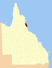 Location within Queensland | |||||||||||||||
| |||||||||||||||
Parishes
Nares is subdivided into parishes, listed as follows:
| Parish | LGA | Coordinates | Towns |
|---|---|---|---|
| Barron | Tablelands | 17°15′S 145°29′E | Atherton, Tolga |
| Bartle Frere | Tablelands | 17°25′S 145°45′E | |
| Bellenden Ker | Cairns | 17°20′S 145°53′E | Babinda, Bellenden Ker, Miriwinni |
| Cairns | Cairns | 16°53′S 145°40′E | Cairns, Kuranda |
| Danbulla | Tablelands | 17°07′S 145°36′E | |
| Dinden | Mareeba | 17°00′S 145°34′E | |
| Dirran | Tablelands | 17°30′S 145°37′E | Tarzali, Millaa Millaa |
| Dulanban | Cairns | 16°40′S 145°33′E | |
| East Barron | Tablelands | 17°19′S 145°33′E | Yungaburra |
| Formartine | Mareeba | 16°52′S 145°29′E | |
| Gadgarra | Tablelands | 17°15′S 145°44′E | |
| Glady | Cassowary Coast | 17°28′S 145°56′E | Flying Fish Point |
| Grafton | Cairns | 17°05′S 145°44′E | Edmonton, Gordonvale |
| Hull | Cassowary Coast | 17°47′S 146°00′E | Silkwood, South Mission Beach, El Arish |
| Japoon | Cassowary Coast | 17°44′S 145°55′E | Japoon |
| Johnstone | Cassowary Coast | 17°36′S 145°55′E | Innisfail, South Johnstone |
| Jordan | Cassowary Coast | 17°39′S 145°45′E | |
| Malanda | Tablelands | 17°22′S 145°37′E | Malanda |
| Monamona | Mareeba | 16°46′S 145°30′E | |
| Mourilyan | Cassowary Coast | 17°37′S 146°03′E | Mourilyan, parts of Innisfail |
| Palmerston | Cassowary Coast | 17°34′S 145°45′E | |
| Russell | Cairns | 17°19′S 145°59′E | Bramston Beach |
| Smithfield | Tablelands | 16°46′S 145°38′E | Northern Beaches |
| Sophia | Cairns | 17°07′S 145°52′E | Aloomba |
| Tinaroo | Mareeba | 17°04′S 145°25′E | Mareeba, Walkamin |
| Trinity | Cairns | 16°58′S 145°49′E | Yarrabah |
References
- Queensland showing counties / compiled and published at the Survey Department, Brisbane, Brisbane : Survey Dept., 1900.
- "Nares – county (entry 23870)". Queensland Place Names. Queensland Government. Retrieved 21 June 2017.
- Chisholm, Hugh, ed. (1911). . Encyclopædia Britannica. Vol. 4 (11th ed.). Cambridge University Press. p. 953.
- Cook District, County of Nares Maps - P9 Series Archived 2011-07-22 at the Wayback Machine at Queensland Archives.
External links
- "Map of the County of Nares (sheet 1)". Queensland Government. 1919.
{{cite web}}: CS1 maint: url-status (link) - "Map of the County of Nares (sheet 2)". Queensland Government. 1919.
{{cite web}}: CS1 maint: url-status (link)
Текст в блоке "Читать" взят с сайта "Википедия" и доступен по лицензии Creative Commons Attribution-ShareAlike; в отдельных случаях могут действовать дополнительные условия.
Другой контент может иметь иную лицензию. Перед использованием материалов сайта WikiSort.org внимательно изучите правила лицензирования конкретных элементов наполнения сайта.
Другой контент может иметь иную лицензию. Перед использованием материалов сайта WikiSort.org внимательно изучите правила лицензирования конкретных элементов наполнения сайта.
2019-2026
WikiSort.org - проект по пересортировке и дополнению контента Википедии
WikiSort.org - проект по пересортировке и дополнению контента Википедии