world.wikisort.org - Australia
The County of Elphinstone is a cadastral division of Queensland which contains the city of Townsville. It was named after George Elphinstone Dalrymple (1826–1876), a politician and explorer.[1] [2] The county is divided into civil parishes.Townsville is mentioned as being in the county of Elphinstone in the 1911 Britannica.[3] It is bounded by the Haughton River in the east, and part of the Burdekin River in the south-west.[4]
| Elphinstone Queensland | |||||||||||||||
|---|---|---|---|---|---|---|---|---|---|---|---|---|---|---|---|
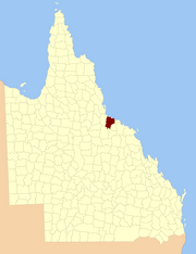 Location within Queensland | |||||||||||||||
| |||||||||||||||
Parishes
Elphinstone is divided into parishes, listed as follows:
| Parish | LGA | Coordinates | Towns |
|---|---|---|---|
| Abbotsford | Burdekin | 19°27′S 147°03′E | Cungulla |
| Beor | Townsville | 19°22′S 146°52′E | Oonoonba |
| Bohle | Townsville | 19°15′S 146°40′E | Deeragun |
| Cardington | Charters Towers | 19°49′S 146°48′E | |
| Coonambelah | Townsville | 19°14′S 146°47′E | Townsville, Kirwan, Pallarenda |
| Crimea | Charters Towers | 19°45′S 146°40′E | |
| Cunningham | Charters Towers | 19°54′S 146°44′E | Mingela |
| Ettrick | Townsville | 19°19′S 147°00′E | |
| Glenrock | Townsville | 19°37′S 146°38′E | |
| Granite | Townsville | 19°30′S 146°37′E | |
| Halifax | Townsville | 19°13′S 146°33′E | Bluewater |
| Hervey | Townsville | 19°21′S 146°30′E | |
| Lansdowne | Townsville | 19°30′S 146°47′E | |
| Magenta | Townsville | 19°38′S 146°52′E | Woodstock |
| Magnetic | Townsville | 19°07′S 146°49′E | Magnetic Island |
| Rokeby | Townsville | 19°32′S 146°56′E | |
| Ross | Townsville | 19°23′S 146°40′E | Alice River, Kelso |
| Scott | Burdekin | 19°34′S 147°03′E | Giru |
| Stuart | Townsville | 19°22′S 146°48′E | Stuart, Annandale, Douglas |
| Woodstock | Townsville | 19°42′S 146°59′E | |
| Wyoming | Townsville | 19°38′S 146°47′E |
References
- "Elphinestone – county (entry 11567)". Queensland Place Names. Queensland Government. Retrieved 21 June 2017.
- Queensland showing counties / compiled and published at the Survey Department, Brisbane, Brisbane : Survey Dept., 1900.
- Chisholm, Hugh, ed. (1911). . Encyclopædia Britannica. Vol. 27 (11th ed.). Cambridge University Press. p. 113.
- North Kennedy District, County of Elphinstone Maps - L6 Series at Queensland Archives.
External links
- "Map of the County of Elphinstone". Queensland Government. 1922.
{{cite web}}: CS1 maint: url-status (link)
Текст в блоке "Читать" взят с сайта "Википедия" и доступен по лицензии Creative Commons Attribution-ShareAlike; в отдельных случаях могут действовать дополнительные условия.
Другой контент может иметь иную лицензию. Перед использованием материалов сайта WikiSort.org внимательно изучите правила лицензирования конкретных элементов наполнения сайта.
Другой контент может иметь иную лицензию. Перед использованием материалов сайта WikiSort.org внимательно изучите правила лицензирования конкретных элементов наполнения сайта.
2019-2026
WikiSort.org - проект по пересортировке и дополнению контента Википедии
WikiSort.org - проект по пересортировке и дополнению контента Википедии