world.wikisort.org - Australia
Coolabah is a small village in western New South Wales, Australia, 76 km north of Nyngan and 656 km north-west of Sydney. It lies on either side of the Mitchell Highway, with the area to the east of the highway in Brewarrina Shire and the westerly area in Bogan Shire.[3][4]
| Coolabah New South Wales | |
|---|---|
 Post office and petrol station, 2007 | |
Coolabah Location in New South Wales | |
| Coordinates | 31°02′S 146°43′E |
| Population | 69 (2016 census)[1] |
| Postcode(s) | 2831[2] |
| Location |
|
| LGA(s) | |
| Region | Orana |
| County | Canbelego |
| Parish | Vega |
| State electorate(s) | Barwon |
| Federal division(s) | Parkes |
History
It took its name from Coolabah, a nearby property.[5]
The railway, its prime reason for its existence, opened in 1884 and closed due to the Nyngan flood on 17 May 1989.[6]
Gallery
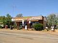 Petrol station, 2007
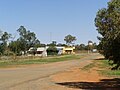 Streetscape of Mitchell Highway Service Road, 2007
 Distances from Coolabah, 2007


References
Wikimedia Commons has media related to Coolabah, New South Wales.
- Australian Bureau of Statistics (27 June 2017). "Coolabah". 2016 Census QuickStats. Retrieved 10 October 2020.
- Coolabah Postcode Australia Post
- "Coolabah". Geographical Names Board. Retrieved 10 October 2020.
- "Coolabah". OpenStreetMap. Retrieved 10 October 2020.
- Staff (8 February 2004). "Coolabah: Tiny village between Nyngan and Bourke" (online ed.). The Sydney Morning Herald. Archived from the original on 18 September 2007. Retrieved 21 April 2017.
- "Main Western Line". NSWRail.net. Retrieved 10 October 2020.
| Preceding station | Former Services | Following station | ||
|---|---|---|---|---|
| Byrock towards Bourke |
Main Western Line | Girilambone towards Sydney | ||
Текст в блоке "Читать" взят с сайта "Википедия" и доступен по лицензии Creative Commons Attribution-ShareAlike; в отдельных случаях могут действовать дополнительные условия.
Другой контент может иметь иную лицензию. Перед использованием материалов сайта WikiSort.org внимательно изучите правила лицензирования конкретных элементов наполнения сайта.
Другой контент может иметь иную лицензию. Перед использованием материалов сайта WikiSort.org внимательно изучите правила лицензирования конкретных элементов наполнения сайта.
2019-2025
WikiSort.org - проект по пересортировке и дополнению контента Википедии
WikiSort.org - проект по пересортировке и дополнению контента Википедии