world.wikisort.org - Australia
The Shire of Beaudesert was a local government area located in South East Queensland, Australia, stretching from the New South Wales border, along the Gold Coast hinterland to the urban fringes of the cities of Brisbane and Ipswich. The Shire covered an area of 2,854.3 square kilometres (1,102.1 sq mi), and existed from 1879 until its abolition on 15 March 2008, following which it was split between Logan City and the new Scenic Rim Region.
| Shire of Beaudesert Queensland | |||||||||||||||
|---|---|---|---|---|---|---|---|---|---|---|---|---|---|---|---|
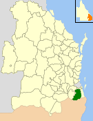 Location within Queensland | |||||||||||||||
| Population | 62,902 (2006 census)[1] | ||||||||||||||
| • Density | 22.0376/km2 (57.0772/sq mi) | ||||||||||||||
| Established | 1879 | ||||||||||||||
| Area | 2,854.3 km2 (1,102.1 sq mi) | ||||||||||||||
| Council seat | Beaudesert | ||||||||||||||
| Region | South East Queensland | ||||||||||||||
 | |||||||||||||||
| Website | Shire of Beaudesert | ||||||||||||||
| |||||||||||||||
History

The Tabragalba Division was incorporated on 11 November 1879 under the Divisional Boards Act 1879 with a population of 869, centred on Beaudesert.[2]
On 18 January 1884, there was an adjustment of boundaries between subdivision No. 1 of Tabragalba Division and subdivision No.2 of the Coomera Division.[3][4]
With the passage of the Local Authorities Act 1902, Tabragalba Division became Shire of Tabragalba on 31 March 1903, and on 8 August 1903 was renamed Shire of Beaudesert by an Order in Council.
On 23 November 1912, a separate Town of Beaudesert was established to manage the town itself, but on 14 September 1929 it was merged back into the shire.[5]
Amalgamations in 1948

On 9 December 1948, as part of a major reorganisation of local government in South East Queensland, an Order in Council replacing ten former local government areas between the City of Brisbane and the New South Wales border with only four.[6][7] The former ten were:
- Beaudesert
- Beenleigh
- Cleveland
- Coolangatta
- Coomera
- Nerang
- Southport
- Tamborine
- Tingalpa
- Waterford
The four resulting local government areas were:
- an enlarged Shire of Beaudesert, an amalgamation of Beaudesert and Tamborine with the western part of Waterford
- the new Shire of Albert: a merger of Beenleigh, Coomera, Nerang (except for the Burleigh Heads area), the southern part of Tingalpa and the eastern part of Waterford[8]
- Town of South Coast, an amalgamation of the Towns of Southport and Coolangatta with the Burleigh Heads part of Nerang (which later became City of Gold Coast)
- the new Redland Shire, an amalgamation of Cleveland and the northern part of Tingalpa (which later became Redland City)
The Order came into effect on 10 June 1949, when the first elections were held.
The enlarged Shire of Beaudesert was split into four divisions with a total of eight councillors—Division 2 with four, Division 4 with two and the others with one each. The chairman (later mayor) was to be chosen from amongst the councillors. The new council was formally established at elections on 31 May 1949 and a Special Meeting was held on 7 June. It had grown 40% in population and gained 1,045 km2 (403 sq mi) in the process.
Growing suburbs
On 8 June 1978, the Shire of Logan was created out of parts of Beaudesert and the Shire of Albert. The council lost 146.1 km2 (56.4 sq mi) of its area and 11,550 people to Logan. At the 1979 council elections, Beaudesert was resubdivided into eight divisions each electing one councillor.
2008 amalgamations
On 15 March 2008, under the Local Government (Reform Implementation) Act 2007 passed by the Parliament of Queensland on 10 August 2007, the Shire of Beaudesert was abolished and became one of only three Queensland councils, alongside Taroom and Tiaro, to be split in two. The northern area, which while still largely rural was part of Brisbane's growth corridor, became part of Logan City, while the southern rural section became part of the Scenic Rim Region alongside the Shire of Boonah.
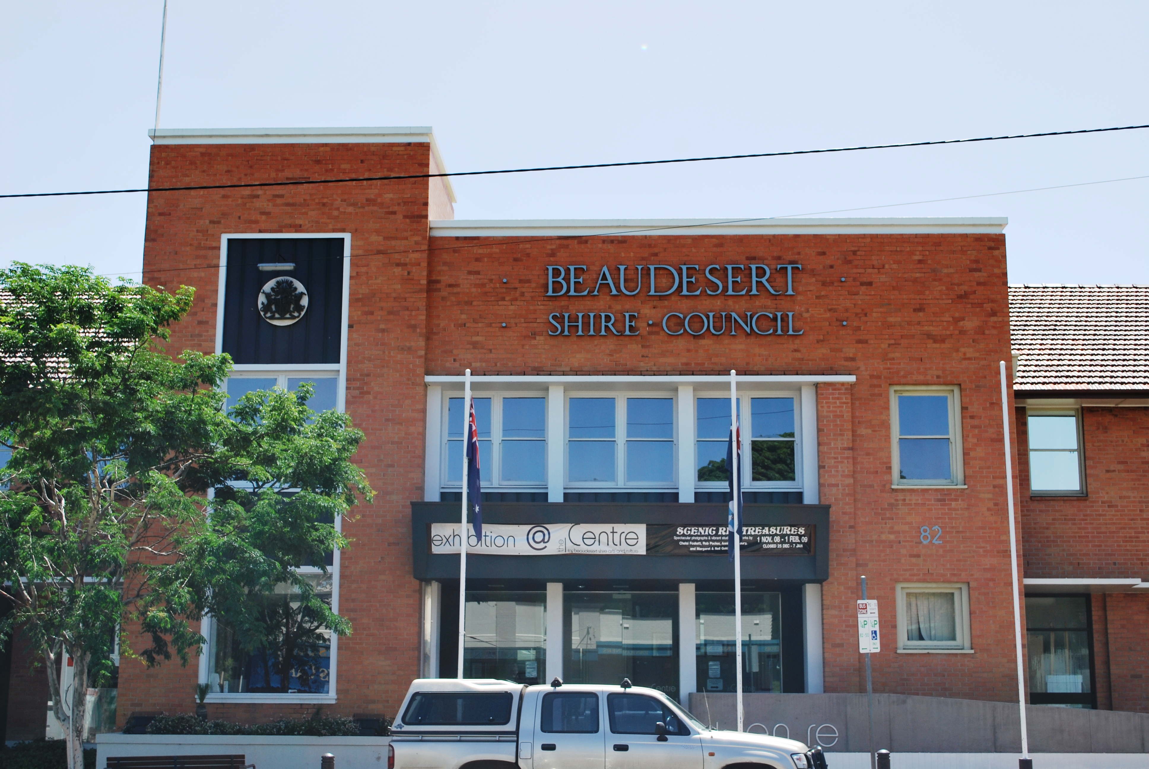
Beaudesert became the administrative centre for the Scenic Rim Region and the Beaudesert Shire Council building now houses the Scenic Rim Regional Council. There are 6 Councillors and a Mayor for an area of 4,238sq km and a regional population of 38,000.
Towns and localities


The Shire of Beaudesert included the following settlements:
Northern Beaudesert section:
|
|
1 - split with the City of Gold Coast
2 - split with Logan City
3 - split with the Scenic Rim Region
Southern Beaudesert section:
|
|
Population
| Year | Population |
|---|---|
| 1933 | 4,915 |
| 1947 | 5,368 # |
| 1954 | 9,543 |
| 1961 | 10,636 |
| 1966 | 12,095 |
| 1971 | 13,434 |
| 1976 | 20,172 |
| 1986 | 26,181 |
| 1991 | 36,349 |
| 1996 | 46,708 |
| 2001 | 53,240 |
| 2006 | 62,902 |
# The estimated 1947 population of the post-1949 area was 8,968.[9]
Chairmen and mayors
The chairmen and mayors of the Beaudesert Division and Shire of Beaudesert were:
- 1915-1916 Tom Plunkett[10]
- 1927-1929: Joseph Hopkins[11][12]
- 1949–1957: James McDonald Sharp
- 1957–1973: Euguene Tilley
- 1973–1977: Andrew Drynan
- 1977–1979: Eugene Tilley
- 1979–1991: Alan Struss
- 1991–1997: Michael Fraser
- 1997–2000: Joy Drescher
- 2000–2004: Ron Munn
- 2004–2008: Joy Drescher
The mayors of the Town of Beaudesert (1912—1929) were:
- 1916: De Burgh Bannatyne Bentinck Persse[13]
- 1917: Stephen Mylett[13]
- 1918-29: Montagu Selwyn Smith[11]
See also
- List of tramways in Queensland
References
- Australian Bureau of Statistics (25 October 2007). "Beaudesert (S) (Local Government Area)". 2006 Census QuickStats. Retrieved 18 March 2008.
- "Proclamation [Tabragalba Division]". Queensland Government Gazette. 11 November 1879. p. 25:989.
- "Proclamation [Tabragalba Division amended]". Queensland Government Gazette. 15 May 1884. p. 34:1483–1484.
- "Proclamation [Coomera Division amended]". Queensland Government Gazette. 15 May 1884. p. 34:1484–1485.
- "Order in Council". Queensland Government Gazette. 14 September 1929. p. 133:801. Abolished Town of Beaudesert and merged it with the Shire.
- "New coast names". The Courier-Mail. Brisbane: National Library of Australia. 10 December 1948. p. 3. Retrieved 5 September 2013.
- "DETAILS OF SOUTH COAST SHIRES". Queensland Times. Ipswich, Queensland: National Library of Australia. 10 December 1948. p. 1 Edition: DAILY. Retrieved 5 September 2013.
- "Agency ID 290, Albert Shire Council". Queensland State Archives. Retrieved 4 September 2013.
- Queensland Year Book, No.11 (1950), p.46.
- "Former Members". Parliament of Queensland. 2015. Retrieved 23 March 2016.
- Pugh, Theophilus Parsons (1927). Pugh's Almanac for 1927. Retrieved 13 June 2014.
- "Veresdale". The Beaudesert Times. Vol. XXII, no. 1124. Queensland, Australia. 6 December 1929. p. 9. Retrieved 22 March 2021 – via National Library of Australia.
- Consolidated Index to Queensland Government Gazette 1859–1919. Queensland Family History Society. 2004. ISBN 1-876613-79-3.
Further reading
- Nutting, Kathleen (1974). Then and now : the story of Beaudesert, 1874–1974. Beaudesert & District Centenary Committee. ISBN 0-9598193-0-4. (59 pages)
External links
- "Beaudesert Shire". Queensland Places. Centre for the Government of Queensland, University of Queensland.
- Official website at the Wayback Machine (archive index)
Другой контент может иметь иную лицензию. Перед использованием материалов сайта WikiSort.org внимательно изучите правила лицензирования конкретных элементов наполнения сайта.
WikiSort.org - проект по пересортировке и дополнению контента Википедии