world.wikisort.org - Australia
Alma is a town in Victoria, Australia, along the Maryborough – St Arnaud Road, west of Maryborough. In the 2006 census, Alma and the surrounding area had a population of 692.[2]
| Alma Victoria | |
|---|---|
 Alma | |
| Coordinates | 37°1′38″S 143°40′40″E |
| Population | 201 (2016 census)[1] |
| Postcode(s) | 3465 |
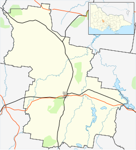
| Location |
|
| LGA(s) | Shire of Central Goldfields |
| State electorate(s) | Ripon |
| Federal division(s) | Mallee |
Alma began as a gold-mining settlement and was named after the Battle of Alma in the Crimean War. It was surveyed in 1860, the Post Office opening on 1 July 1861.[3] (closed 1969), and proclaimed in 1891. It had a peak population of 2,109.
References
- Australian Bureau of Statistics (27 June 2017). "Alma (State Suburb)". 2016 Census QuickStats. Retrieved 24 August 2020.
- Australian Bureau of Statistics (25 October 2007). "Alma (State Suburb)". 2006 Census QuickStats. Retrieved 16 March 2010.
- Phoenix Auctions History, Post Office List, retrieved 6 March 2021
This article about a location in Victoria, Australia is a stub. You can help Wikipedia by expanding it. |
Текст в блоке "Читать" взят с сайта "Википедия" и доступен по лицензии Creative Commons Attribution-ShareAlike; в отдельных случаях могут действовать дополнительные условия.
Другой контент может иметь иную лицензию. Перед использованием материалов сайта WikiSort.org внимательно изучите правила лицензирования конкретных элементов наполнения сайта.
Другой контент может иметь иную лицензию. Перед использованием материалов сайта WikiSort.org внимательно изучите правила лицензирования конкретных элементов наполнения сайта.
2019-2026
WikiSort.org - проект по пересортировке и дополнению контента Википедии
WikiSort.org - проект по пересортировке и дополнению контента Википедии