world.wikisort.org - Australien
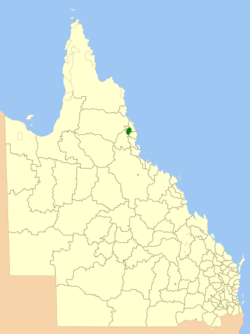
Der Shire of Echam war ein Verwaltungsbezirk in Queensland, Australien. Er umfasste die Städte Butchers Creek, Jaggan, Millaa Millaa, Peeramon, Tarzali, Yungaburra und Malanda. Am 17. März 2008 ging er im Tablelands Regional Council auf.
| Shire of Eacham | |||||||
|---|---|---|---|---|---|---|---|
| |||||||
| |||||||
| |||||||
 | |||||||
Bevölkerungsentwicklung
| Jahr | Einwohner |
|---|---|
| 1933 | 4.324 |
| 1947 | 3.740 |
| 1954 | 3.771 |
| 1961 | 3.842 |
| 1966 | 3.598 |
| 1971 | 3.327 |
| 1976 | 3.433 |
| 1981 | 4.137 |
| 1986 | 5.135 |
| 1991 | 5.609 |
| 1996 | 6.074 |
| 2001 | 6.076 |
| 2006 | 6.359[1] |
Bürgermeister
- Philip English (1988–2000)
- Mary Lyle (2000–2004)
- Ray Byrnes (2004–2008)
Weblinks
Einzelnachweise
- Eacham (S) (Local Government Area). 2006 Census Quickstat. Australian Bureau of Statistics, 25. Oktober 2007, abgerufen am 22. April 2013 (englisch).
На других языках
- [de] Shire of Eacham
[en] Shire of Eacham
The Shire of Eacham was a local government area of Queensland. It was located on the Atherton Tableland, a plateau forming part of the Great Dividing Range west of the city of Cairns. The shire, administered from the town of Malanda, covered an area of 1,126.4 square kilometres (434.9 sq mi), and existed as a local government entity from 1910 until 2008, when it amalgamated with several other councils in the Tableland area to become the Tablelands Region.Текст в блоке "Читать" взят с сайта "Википедия" и доступен по лицензии Creative Commons Attribution-ShareAlike; в отдельных случаях могут действовать дополнительные условия.
Другой контент может иметь иную лицензию. Перед использованием материалов сайта WikiSort.org внимательно изучите правила лицензирования конкретных элементов наполнения сайта.
Другой контент может иметь иную лицензию. Перед использованием материалов сайта WikiSort.org внимательно изучите правила лицензирования конкретных элементов наполнения сайта.
2019-2026
WikiSort.org - проект по пересортировке и дополнению контента Википедии
WikiSort.org - проект по пересортировке и дополнению контента Википедии