world.wikisort.org - Australien
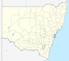
Gilgandra ist der Hauptort des Gilgandra Shire und liegt in New South Wales in Australien. Der Ort liegt am Warrumbungle-Nationalpark an der Kreuzung des Newell Highways, des Oxley Highways und des Castlereagh Highways. Die Kleinstadt liegt außerdem am Castlereagh River.
| Gilgandra | |||||||
|---|---|---|---|---|---|---|---|
 Hauptstraße | |||||||
| |||||||
| |||||||
| |||||||
| |||||||
Etymologie
Das Wort Gilgandra kommt aus der Sprache der Aborigines und bedeutet langes Wasserloch, was möglicherweise für den Castlereagh River steht.
Geographie
Die Landschaft um Gilgandra ist sehr flach. Die Böden bestehen größtenteils aus Sand.
Klima
Während im Sommer hohe Temperaturen von bis zu 40 °C erreicht werden können, kann im Winter das Thermometer auf −2 °C und Schnee fallen. 1955 war die Kleinstadt von einer Flutkatastrophe betroffen. Später jedoch wurde der Ort von Dürren heimgesucht.
Geschichte
Gilgandra wurde 1888 gegründet.
Söhne der Stadt
- Donald Frederick Gregory O'Connor (Cricketspieler)
- William Thomas Hitchen
Weblinks
Einzelnachweise
- Gilgandra. 2021 Census Quickstat. Australian Bureau of Statistics, 28. Juni 2022, abgerufen am 27. Oktober 2022 (englisch).
На других языках
- [de] Gilgandra
[en] Gilgandra, New South Wales
Gilgandra is a country town in the Orana region of New South Wales, Australia, and services the surrounding agricultural area where wheat is grown extensively together with other cereal crops, and sheep and beef cattle are raised.[2] Sitting at the junction of the Newell, Oxley and Castlereagh highways, the town is located in a wide bend of the Castlereagh River downstream from its source near Coonabarabran, directly downstream from Mendooran, and upstream from Gulargambone and Coonamble.[3] It is 432 km north-west of Sydney (about six hours' driving time), and is located approximately halfway on the inland route from Melbourne to Brisbane. The town is the administrative seat of the Gilgandra Shire.[4] It is known as the town of windmills and the home of the 'Coo-ees', and is a gateway to the Warrumbungles National Park.Другой контент может иметь иную лицензию. Перед использованием материалов сайта WikiSort.org внимательно изучите правила лицензирования конкретных элементов наполнения сайта.
WikiSort.org - проект по пересортировке и дополнению контента Википедии
