world.wikisort.org - Argentina
Andalgalá is a city in the west-center of the province of Catamarca, Argentina, located in a valley near the Sierra de Aconquija, 260 km from the provincial capital San Fernando del Valle de Catamarca. It has about 14,000 inhabitants as per the 2001 census [INDEC]. It is the head town of the department of the same name. The Andalgalá River, which flows nearby, supports a hydroelectric power plant.
Ciudad de Andalgalá | |
|---|---|
City | |
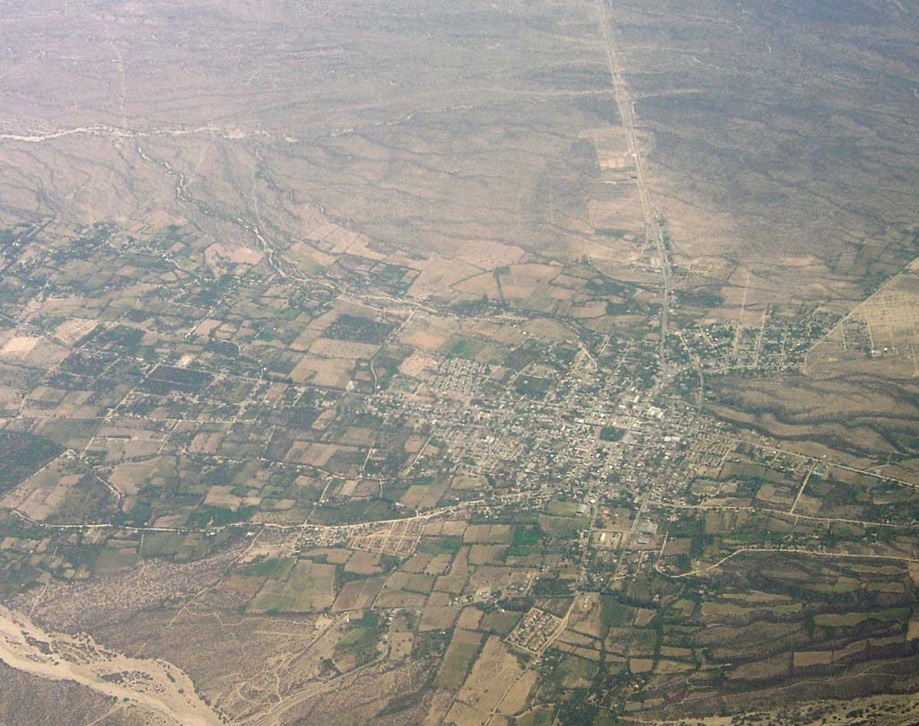 Aerial view | |
 Ciudad de Andalgalá Location of Andalgalá in Argentina | |
| Coordinates: 27°36′S 66°19′W | |
| Country | |
| Province | |
| Department | Andalgalá |
| Elevation | 960 m (3,150 ft) |
| Population (2001 census) | |
| • Total | 14,068 |
| Time zone | UTC-3 (ART) |
| CPA base | K4740 |
| Dialing code | +54 3835 |
Andalgalá was founded as a fort on 12 July 1658, and only became a city in 1952. Its name is of Quechua origin and means either "Lord of the Hare" or "Lord of the High Mountain".
Climate
According to the Köppen Climate Classification system, Andalgalá has a semi-arid climate, abbreviated "BSk" on climate maps.[1] Precipitation is mainly concentrated from November to March with 80% of the annual precipitation occurring in these months.[2]
| Climate data for Andalgalá (1901–1960) | |||||||||||||
|---|---|---|---|---|---|---|---|---|---|---|---|---|---|
| Month | Jan | Feb | Mar | Apr | May | Jun | Jul | Aug | Sep | Oct | Nov | Dec | Year |
| Record high °C (°F) | 43.4 (110.1) |
43.1 (109.6) |
39.9 (103.8) |
38.7 (101.7) |
36.3 (97.3) |
35.3 (95.5) |
37.2 (99.0) |
39.3 (102.7) |
39.9 (103.8) |
42.2 (108.0) |
41.9 (107.4) |
43.3 (109.9) |
43.4 (110.1) |
| Average high °C (°F) | 33.7 (92.7) |
32.3 (90.1) |
30.1 (86.2) |
26.2 (79.2) |
21.7 (71.1) |
18.3 (64.9) |
18.7 (65.7) |
21.5 (70.7) |
25.5 (77.9) |
28.9 (84.0) |
31.9 (89.4) |
33.7 (92.7) |
26.9 (80.4) |
| Daily mean °C (°F) | 25.1 (77.2) |
24.0 (75.2) |
21.9 (71.4) |
17.9 (64.2) |
13.7 (56.7) |
9.9 (49.8) |
10.0 (50.0) |
12.7 (54.9) |
16.7 (62.1) |
20.1 (68.2) |
22.9 (73.2) |
25.0 (77.0) |
18.3 (64.9) |
| Average low °C (°F) | 18.4 (65.1) |
17.7 (63.9) |
15.7 (60.3) |
11.3 (52.3) |
7.2 (45.0) |
3.7 (38.7) |
3.3 (37.9) |
5.2 (41.4) |
8.9 (48.0) |
12.3 (54.1) |
15.4 (59.7) |
17.4 (63.3) |
11.4 (52.5) |
| Record low °C (°F) | 8.7 (47.7) |
9.1 (48.4) |
4.8 (40.6) |
−1.8 (28.8) |
−3.1 (26.4) |
−4.7 (23.5) |
−6.2 (20.8) |
−5.7 (21.7) |
−2.5 (27.5) |
1.7 (35.1) |
2.1 (35.8) |
4.9 (40.8) |
−6.2 (20.8) |
| Average precipitation mm (inches) | 75.5 (2.97) |
64.8 (2.55) |
45.7 (1.80) |
15.8 (0.62) |
8.4 (0.33) |
4.4 (0.17) |
5.4 (0.21) |
5.2 (0.20) |
4.8 (0.19) |
13.7 (0.54) |
18.7 (0.74) |
35.3 (1.39) |
297.5 (11.71) |
| Average relative humidity (%) | 53.0 | 60.2 | 62.8 | 64.2 | 64.3 | 63.5 | 55.2 | 48.2 | 46.7 | 50.0 | 50.2 | 51.7 | 55.8 |
| Mean monthly sunshine hours | 291 | 234 | 248 | 223 | 230 | 176 | 205 | 223 | 254 | 275 | 273 | 264 | 2,897 |
| Percent possible sunshine | 69 | 64 | 65 | 65 | 69 | 56 | 62 | 64 | 70 | 70 | 67 | 62 | 65 |
| Source 1: Secretaria de Mineria[2] | |||||||||||||
| Source 2: FAO (sun only)[3] | |||||||||||||
References
- Climate Summary for Andalgala
- "Provincia de Catamarca - Clima Y Meteorologia: Datos Meteorológicos Registrados en la estación Andalgalá en el periodo 1901–1960" (in Spanish). Secretaria de Mineria de la Nacion (Argentina). Archived from the original on October 4, 2015. Retrieved February 19, 2014.
- "Cuadro 13: Sumas Mensuales y Anuales de las Horas de Sol Efectivas y Porcentaje de los Totales de Horas de Sol" (PDF). Estudio Sobre la Rehabilitacion de Tierras en el Valle de Viedma: Informed Final–Volumen II (in Spanish). Food and Agriculture Organization. p. 97. Retrieved July 13, 2015.
- Municipal information: Municipal Affairs Federal Institute (IFAM), Municipal Affairs Secretariat, Ministry of Interior, Argentina. (in Spanish)
- Provincia de Catamarca — Official portal.
- Catamarca Huasi — Provincial portal. Details on the Andalgalá Department.
- Catamarca Guía
- Andalgala News
Settlements in Catamarca Province | ||
|---|---|---|
| Ambato Department |
|  |
| Ancasti Department |
| |
| Andalgalá Department |
| |
| Antofagasta de la Sierra Department |
| |
| Belén Department |
| |
| Capayán Department |
| |
| Capital Department |
| |
| El Alto Department |
| |
| Fray Mamerto Esquiú Department |
| |
| La Paz Department |
| |
| Paclín Department |
| |
| Pomán Department |
| |
| Santa Maria Department |
| |
| Santa Rosa Department |
| |
| Tinogasta Department |
| |
| Valle Viejo Department |
| |
Authority control | |
|---|---|
| General |
|
| National libraries | |
Другой контент может иметь иную лицензию. Перед использованием материалов сайта WikiSort.org внимательно изучите правила лицензирования конкретных элементов наполнения сайта.
WikiSort.org - проект по пересортировке и дополнению контента Википедии