world.wikisort.org - Algeria
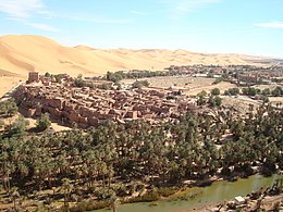
Taghit è un comune dell'Algeria, situato nella provincia di Béchar.
| Taghit comune | |
|---|---|
| تاغيت | |
 | |
| Localizzazione | |
| Stato | |
| Provincia | Béchar |
| Distretto | Taghit |
| Territorio | |
| Coordinate | 30°55′N 2°02′W |
| Altitudine | 623 m s.l.m. |
| Superficie | 8 040 km² |
| Abitanti | 6 505 (2008) |
| Densità | 0,81 ab./km² |
| Altre informazioni | |
| Cod. postale | 08230 |
| Fuso orario | UTC+1 |
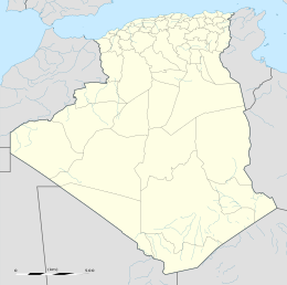
| Cartografia | |
 | |
Altri progetti
 Wikimedia Commons contiene immagini o altri file su Taghit
Collegamenti esterni
- (EN) Lista di comuni dell'Algeria, su statoids.com.
| Controllo di autorità | VIAF (EN) 125625538 · LCCN (EN) n91081905 · WorldCat Identities (EN) lccn-n91081905 |
|---|
На других языках
[de] Taghit
Taghit (arabisch تاغيت, Tifinagh-Schrift ⵜⴰⵖⵉⵜ) ist eine algerische Kleinstadt und Hauptort des gleichnamigen Distrikts in der Provinz (wilaya) Bechar. Im Jahr 2007 wurde der etwa 250.000 Hektar umfassende Taghit-Nationalpark eingeweiht.[en] Taghit
Taghit (Arabic: ﺗﺎﻏﻴﺖ) is a town and commune in Taghit District, Béchar Province, in western Algeria. The town is an oasis watered by the underground Oued Zousfana, which runs along beside the dunes of the Grand Erg Occidental.[3] According to the 2008 census its population is 6,317,[2] up from 6,047 in 1998,[4] with an annual growth rate of 0.4%.[2] The commune covers an area of 8,080 square kilometres (3,120 sq mi).[1][fr] Taghit
Taghit est une commune de la Wilaya de Béchar en Algérie, située à 93 km au sud-est de Béchar.- [it] Taghit
Текст в блоке "Читать" взят с сайта "Википедия" и доступен по лицензии Creative Commons Attribution-ShareAlike; в отдельных случаях могут действовать дополнительные условия.
Другой контент может иметь иную лицензию. Перед использованием материалов сайта WikiSort.org внимательно изучите правила лицензирования конкретных элементов наполнения сайта.
Другой контент может иметь иную лицензию. Перед использованием материалов сайта WikiSort.org внимательно изучите правила лицензирования конкретных элементов наполнения сайта.
2019-2025
WikiSort.org - проект по пересортировке и дополнению контента Википедии
WikiSort.org - проект по пересортировке и дополнению контента Википедии
