world.wikisort.org - Algeria
Oum el Assel è un comune dell'Algeria, situato nella provincia di Tindouf.
| Oum el Assel comune | |
|---|---|
| أم العسل | |
 | |
| Localizzazione | |
| Stato | |
| Provincia | Tindouf |
| Distretto | Tindouf |
| Territorio | |
| Coordinate | 28°36′45″N 6°58′44″W |
| Altitudine | 526 m s.l.m. |
| Superficie | 88 865 km² |
| Abitanti | 3 183 (2008) |
| Densità | 0,04 ab./km² |
| Altre informazioni | |
| Cod. postale | 37010 |
| Fuso orario | UTC+1 |
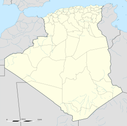
| Cartografia | |
 | |
Altri progetti
 Wikimedia Commons contiene immagini o altri file su Oum el Assel
Collegamenti esterni
- (EN) Lista di comuni dell'Algeria, su statoids.com.
На других языках
[en] Oum El Assel
Oum El Assel (Arabic: أم العسل, lit. mother of the honey) is a town and commune in the district and province of Tindouf, Algeria. At the 2008 census it had a population of 3,183,[1] up from 1,794 in 1998,[2] and an annual population growth rate of 6.0%.[1] It is the least populated, largest, and least densely populated of the two communes which form the province (the other one being Tindouf). The town of Oum El Assel is located on the southern side of the N50 national highway 150 kilometres (93 mi) northeast of Tindouf.[fr] Oum el Assel
Oum el Assel (en arabe : أم العسل), nommée Reguibat jusqu'en 1980[3], est une commune de la wilaya de Tindouf en Algérie, située à 210 km au nord-est de Tindouf et 1 300 km au sud-ouest d'Alger.- [it] Oum el Assel
Текст в блоке "Читать" взят с сайта "Википедия" и доступен по лицензии Creative Commons Attribution-ShareAlike; в отдельных случаях могут действовать дополнительные условия.
Другой контент может иметь иную лицензию. Перед использованием материалов сайта WikiSort.org внимательно изучите правила лицензирования конкретных элементов наполнения сайта.
Другой контент может иметь иную лицензию. Перед использованием материалов сайта WikiSort.org внимательно изучите правила лицензирования конкретных элементов наполнения сайта.
2019-2025
WikiSort.org - проект по пересортировке и дополнению контента Википедии
WikiSort.org - проект по пересортировке и дополнению контента Википедии
