world.wikisort.org - Algeria
Aïn Taya è un comune dell'Algeria, situato nella provincia di Algeri.
| Aïn Taya comune | |
|---|---|
| عين طايه | |
 | |
| Localizzazione | |
| Stato | |
| Provincia | Algeri |
| Distretto | Dar El Beïda |
| Territorio | |
| Coordinate | 36°47′30″N 3°17′20″E |
| Altitudine | 26 m s.l.m. |
| Superficie | 8,71 km² |
| Abitanti | 34 501 (2008) |
| Densità | 3 961,08 ab./km² |
| Altre informazioni | |
| Cod. postale | 16019 |
| Fuso orario | UTC+1 |
| Codice ONS | 1638 |
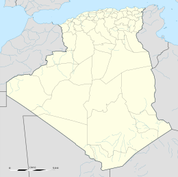
| Cartografia | |
 | |
Altri progetti
 Wikimedia Commons contiene immagini o altri file su Aïn Taya
Collegamenti esterni
- (EN) Lista di comuni dell'Algeria, su statoids.com.
На других языках
[en] Aïn Taya
Aïn Taya is a suburb of Algiers, Algeria. It is located in the administrative constituency of Dar El Beïda in the Governorate of Greater Algiers. Its postal code is 16019 and its municipal code is 1638. Prior to its being part of the Governorate of Greater Algiers, it was part of Boumerdès Province with postal code 35310. The current president of the People's Municipal Assembly'(mayor) is Abdelkader Rakkas (2017-2022). Aïn Taya has a budget of 46 million DZD.[fr] Aïn Taya
Aïn Taya ou Aïn Taïa (en arabe عين طاية), est une commune de la wilaya d'Alger en Algérie, située dans la banlieue Est d'Alger[2].- [it] Aïn Taya
Текст в блоке "Читать" взят с сайта "Википедия" и доступен по лицензии Creative Commons Attribution-ShareAlike; в отдельных случаях могут действовать дополнительные условия.
Другой контент может иметь иную лицензию. Перед использованием материалов сайта WikiSort.org внимательно изучите правила лицензирования конкретных элементов наполнения сайта.
Другой контент может иметь иную лицензию. Перед использованием материалов сайта WikiSort.org внимательно изучите правила лицензирования конкретных элементов наполнения сайта.
2019-2025
WikiSort.org - проект по пересортировке и дополнению контента Википедии
WikiSort.org - проект по пересортировке и дополнению контента Википедии
