world.wikisort.org - Algeria
Saïda (Arabic: ولاية سعيدة) is a province (wilaya) of Algeria, named after its capital.
Saïda Province
ولاية سعيدة | |
|---|---|
Province | |
 Map of Algeria highlighting Saïda | |
| Coordinates: 34°50′N 0°09′E | |
| Country | |
| Capital | Saïda |
| Area | |
| • Total | 6,764 km2 (2,612 sq mi) |
| Population (2008)[1] | |
| • Total | 328,685 |
| • Density | 49/km2 (130/sq mi) |
| Time zone | UTC+01 (CET) |
| Area Code | +213 (0) 48 |
| ISO 3166 code | DZ-20 |
| Districts | 6 |
| Municipalities | 16 |
History
The province was created from parts of Oran department, Saïda province and Saoura province in 1974.
In 1984 El Bayadh Province and Naama Province were carved out of its territory.
Administrative divisions
The province is divided into 6 districts (daïras), which are further divided into 16 communes or municipalities.
Districts
Communes
- Aïn El Hadjar
- Aïn Sekhouna
- Aïn Soltane
- Doui Thabet
- El Hassasna
- Hounet
- Maamora
- Moulay Larbi
- Ouled Brahim
- Ouled Khaled
- Saïda
- Sidi Ahmed
- Sidi Amar
- Sidi Boubekeur
- Tircine
- Youb
References
- Office National des Statistiques, Recensement General de la Population et de l’Habitat 2008 Archived 2008-07-24 at the Wayback Machine Preliminary results of the 2008 population census. Accessed on 2008-07-02.
Wikimedia Commons has media related to Saïda Province.
Capital: Saïda | ||
| Districts | 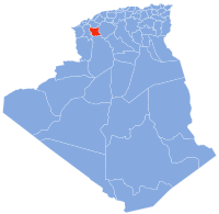 | |
| Communes |
| |
|  | |
Authority control | |
|---|---|
| General |
|
| National libraries | |
| Other |
|
This article about a location in Saïda Province is a stub. You can help Wikipedia by expanding it. |
На других языках
- [en] Saïda Province
[ru] Саида (вилайет)
Саи́да[2][3] (араб. ولاية سعيدة) — вилайет[4] в северо-западной части Алжира.Текст в блоке "Читать" взят с сайта "Википедия" и доступен по лицензии Creative Commons Attribution-ShareAlike; в отдельных случаях могут действовать дополнительные условия.
Другой контент может иметь иную лицензию. Перед использованием материалов сайта WikiSort.org внимательно изучите правила лицензирования конкретных элементов наполнения сайта.
Другой контент может иметь иную лицензию. Перед использованием материалов сайта WikiSort.org внимательно изучите правила лицензирования конкретных элементов наполнения сайта.
2019-2026
WikiSort.org - проект по пересортировке и дополнению контента Википедии
WikiSort.org - проект по пересортировке и дополнению контента Википедии