world.wikisort.org - Algeria
Oufrane is a village in the commune of Metarfa,[1] in Aougrout District, Adrar Province, Algeria. It is located 87 kilometres (54 mi) northeast of Adrar and 79 kilometres (49 mi) south of Timimoun.[2]
Oufrane | |
|---|---|
Village | |
 Oufrane | |
| Coordinates: 28°32′29″N 0°10′59″E | |
| Country | |
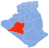
| Province | Adrar Province |
| District | Aougrout District |
| Commune | Metarfa[1] |
| Elevation | 290 m (950 ft) |
| Time zone | UTC+1 (CET) |
Climate
Oufrane has a hot desert climate (Köppen climate classification BWh), with extremely hot summers and mild winters, and very little precipitation throughout the year.
| Climate data for Oufrane | |||||||||||||
|---|---|---|---|---|---|---|---|---|---|---|---|---|---|
| Month | Jan | Feb | Mar | Apr | May | Jun | Jul | Aug | Sep | Oct | Nov | Dec | Year |
| Average high °C (°F) | 19.8 (67.6) |
22.5 (72.5) |
27.3 (81.1) |
32.4 (90.3) |
36.3 (97.3) |
42.5 (108.5) |
45.4 (113.7) |
44.1 (111.4) |
40.0 (104.0) |
32.8 (91.0) |
25.1 (77.2) |
18.4 (65.1) |
32.2 (90.0) |
| Daily mean °C (°F) | 12.1 (53.8) |
14.7 (58.5) |
19.0 (66.2) |
24.1 (75.4) |
28.0 (82.4) |
33.8 (92.8) |
36.7 (98.1) |
35.7 (96.3) |
32.0 (89.6) |
25.2 (77.4) |
18.0 (64.4) |
12.1 (53.8) |
24.3 (75.7) |
| Average low °C (°F) | 4.4 (39.9) |
6.9 (44.4) |
10.8 (51.4) |
15.8 (60.4) |
19.7 (67.5) |
25.2 (77.4) |
28.0 (82.4) |
27.3 (81.1) |
24.1 (75.4) |
17.7 (63.9) |
11.0 (51.8) |
5.9 (42.6) |
16.4 (61.5) |
| Average precipitation mm (inches) | 1 (0.0) |
2 (0.1) |
3 (0.1) |
1 (0.0) |
0 (0) |
0 (0) |
0 (0) |
0 (0) |
1 (0.0) |
2 (0.1) |
2 (0.1) |
2 (0.1) |
14 (0.5) |
| Source: climate-data.org[3] | |||||||||||||
References
- "Décret n° 84-365, fixant la composition, la consistance et les limites territoriale des communes. Wilaya d'Adrar" (PDF) (in French). Journal officiel de la République Algérienne. 19 December 1984. p. 1473. Archived from the original (PDF) on 2012-01-15. Retrieved 22 July 2013.
- "Oufrane, Algeria". Geonames.org. Retrieved 22 July 2013.
- "Climate data for: Oufrane". climate-data.org. Retrieved 22 July 2013.
Neighbouring towns and cities
Places adjacent to Oufrane | |
|---|---|
Capital: Adrar | ||
| Districts |
|  |
| Communes |
| |
This article about a location in Adrar Province is a stub. You can help Wikipedia by expanding it. |
Текст в блоке "Читать" взят с сайта "Википедия" и доступен по лицензии Creative Commons Attribution-ShareAlike; в отдельных случаях могут действовать дополнительные условия.
Другой контент может иметь иную лицензию. Перед использованием материалов сайта WikiSort.org внимательно изучите правила лицензирования конкретных элементов наполнения сайта.
Другой контент может иметь иную лицензию. Перед использованием материалов сайта WikiSort.org внимательно изучите правила лицензирования конкретных элементов наполнения сайта.
2019-2026
WikiSort.org - проект по пересортировке и дополнению контента Википедии
WikiSort.org - проект по пересортировке и дополнению контента Википедии