world.wikisort.org - Algeria
H'raoua is a municipality in Algiers province, Algeria. It is located in Rouïba district, and is an outer suburb of Algiers. It has a small coastline on the Mediterranean Sea. The town proper (chef-lieu agglomeration) of H'raoua is located 2 kilometers (1.2 mi) from the beaches of Terfaya and Kadous. It was created out of parts of Aïn Taya in 1984. Currently, it is the site of the construction of 1853 homes.[citation needed]
H'raoua
الهراوة | |
|---|---|
Municipality | |
| Commune of H'raoua | |
 | |
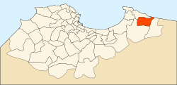 Location of H'raoua within Algiers Province | |
 H'raoua Location of H'raoua within Algeria | |
| Coordinates: 36°46′N 3°19′E | |
| Country | |
| Province | Algiers |
| District | Rouïba |
| Government | |
| • PMA Seats | 11 |
| • PMA president | Mr. Allal Bessaâd (2002-2007) |
| Area | |
| • Total | 13 km2 (5 sq mi) |
| Population (1998) | |
| • Total | 18,167 |
| • Density | 1,400/km2 (3,600/sq mi) |
| Time zone | UTC+01 (CET) |
| Postal code | 16900 |
| ONS code | 1641 |
Notable people
| Zéralda District |  | |
|---|---|---|
| Chéraga District |
| |
| Draria District |
| |
| Birtouta District |
| |
| Bir Mourad Raïs District |
| |
| Bouzaréah District |
| |
| Bab El Oued District |
| |
| Hussein Dey District |
| |
| Sidi M'Hamed District |
| |
| El Harrach District |
| |
| Baraki District |
| |
| Dar El Beïda District |
| |
| Rouïba District | ||
This article about a location in Algiers Province is a stub. You can help Wikipedia by expanding it. |
Текст в блоке "Читать" взят с сайта "Википедия" и доступен по лицензии Creative Commons Attribution-ShareAlike; в отдельных случаях могут действовать дополнительные условия.
Другой контент может иметь иную лицензию. Перед использованием материалов сайта WikiSort.org внимательно изучите правила лицензирования конкретных элементов наполнения сайта.
Другой контент может иметь иную лицензию. Перед использованием материалов сайта WikiSort.org внимательно изучите правила лицензирования конкретных элементов наполнения сайта.
2019-2026
WikiSort.org - проект по пересортировке и дополнению контента Википедии
WikiSort.org - проект по пересортировке и дополнению контента Википедии