world.wikisort.org - Etats-Unis
South Bethlehem est un borough situé dans le comté d'Armstrong, en Pennsylvanie, aux États-Unis[1],[2]. En 2010, il comptait une population de 481 habitants. Il est incorporé en 1874[1].
Pour les articles homonymes, voir South Bethlehem.
Cet article est une ébauche concernant une localité de Pennsylvanie.
Vous pouvez partager vos connaissances en l’améliorant (comment ?) selon les recommandations des projets correspondants.
| South Bethlehem | ||||
 Broad Street à South Bethlehem. | ||||
| Administration | ||||
|---|---|---|---|---|
| Pays | ||||
| État | ||||
| Comté | Armstrong | |||
| Type de localité | Borough | |||
| Code ZIP | 16242 | |||
| Code FIPS | 42-71976 | |||
| GNIS | 1193395 | |||
| Indicatif(s) téléphonique(s) local (locaux) | 724 | |||
| Démographie | ||||
| Population | 481 hab. (2010) | |||
| Densité | 1 233 hab./km2 | |||
| Géographie | ||||
| Coordonnées | 40° 59′ 58″ nord, 79° 20′ 21″ ouest | |||
| Altitude | 332 m |
|||
| Superficie | 39 ha = 0,39 km2 | |||
| · dont terre | 0,39 km2 (100 %) | |||
| · dont eau | 0 km2 (0 %) | |||
| Fuseau horaire | EST (UTC-5) | |||
| Divers | ||||
| Municipalité depuis | Incorporation en 1874[1]. | |||
| Localisation | ||||
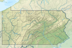
 Carte du comté d'Armstrong. | ||||
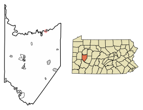
| Géolocalisation sur la carte : Pennsylvanie
Géolocalisation sur la carte : États-Unis
Géolocalisation sur la carte : États-Unis
| ||||
| modifier |
||||


Démographie
Lors du recensement de 2010, le borough comptait une population de 481 habitants. Elle est estimée, le , à 469 habitants.
| Historique des recensements | |||
| Ann. | Pop. | %± | |
|---|---|---|---|
| 1890 | 111 | — | |
| 1900 | 183 | ▲ +64,86 % | |
| 1910 | 439 | ▲ +139,89 % | |
| 1920 | 485 | ▲ +10,48 % | |
| 1930 | 469 | ▼ −3,3 % | |
| 1940 | 561 | ▲ +19,62 % | |
| 1950 | 489 | ▼ −12,83 % | |
| 1960 | 510 | ▲ +4,29 % | |
| 1970 | 500 | ▼ −1,96 % | |
| 1980 | 476 | ▼ −4,8 % | |
| 1990 | 479 | ▲ +0,63 % | |
| 2000 | 444 | ▼ −7,31 % | |
| 2010 | 481 | ▲ +8,33 % | |
| Est. 2019 | 469 | [3] | ▼ −2,49 % |
| le site pennsylvania.hometownlocator.com | |||
Références
- (en) « South Bethlehem, Armstrong, Missouri (IL) detailed profile » [« Données sur South Bethlehem, comté d'Armstrong, Pennsylvanie »], sur city-data.com (consulté le ).
- (en) « South Bethlehem (Pennsylvanie) », Geographic Names Information System
- (en) « South Bethlehem, PA Profile: Facts & Data », sur le site pennsylvania.hometownlocator.com (consulté le ).
Voir aussi
Articles connexes
- Pennsylvanie
- Comtés du Commonwealth de Pennsylvanie
- Liste des municipalités en Pennsylvanie
Liens externes
- Ressource relative à la géographie :
Source de la traduction
- (en) Cet article est partiellement ou en totalité issu de l’article de Wikipédia en anglais intitulé « South Bethlehem, Pennsylvania » (voir la liste des auteurs).
 Portail de la Pennsylvanie
На других языках
[en] South Bethlehem, Pennsylvania
South Bethlehem is a borough in Armstrong County, Pennsylvania. The population was 481 at the 2010 census.[3]- [fr] South Bethlehem (Pennsylvanie)
Текст в блоке "Читать" взят с сайта "Википедия" и доступен по лицензии Creative Commons Attribution-ShareAlike; в отдельных случаях могут действовать дополнительные условия.
Другой контент может иметь иную лицензию. Перед использованием материалов сайта WikiSort.org внимательно изучите правила лицензирования конкретных элементов наполнения сайта.
Другой контент может иметь иную лицензию. Перед использованием материалов сайта WikiSort.org внимательно изучите правила лицензирования конкретных элементов наполнения сайта.
2019-2025
WikiSort.org - проект по пересортировке и дополнению контента Википедии
WikiSort.org - проект по пересортировке и дополнению контента Википедии