world.wikisort.org - Etats-Unis
Felt est une census-designated place américaine située dans le comté de Cimarron dans l’État de l'Oklahoma.
| Felt | ||||
| Administration | ||||
|---|---|---|---|---|
| Pays | ||||
| État | ||||
| Comtés | Cimarron | |||
| Type de localité | Census-designated place | |||
| Code ZIP | 73937 | |||
| Code FIPS | 40-25850 | |||
| Démographie | ||||
| Population | 93 hab. (2010) | |||
| Densité | 68 hab./km2 | |||
| Géographie | ||||
| Coordonnées | 36° 34′ 03″ nord, 102° 47′ 37″ ouest | |||
| Altitude | 1 360 m |
|||
| Superficie | 136 ha = 1,36 km2 | |||
| Fuseau horaire | CST (UTC-6) | |||
| Localisation | ||||
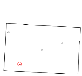 Carte des comtés de Cimarron. | ||||
| Géolocalisation sur la carte : États-Unis
Géolocalisation sur la carte : États-Unis
Géolocalisation sur la carte : Oklahoma
| ||||
| modifier |
||||


Démographie
| Historique des recensements | |||
| Ann. | Pop. | %± | |
|---|---|---|---|
| 2000 | 125 | — | |
| 2010 | 93 | ▼ −25,6 % | |
Traduction
- (en) Cet article est partiellement ou en totalité issu de l’article de Wikipédia en anglais intitulé « Felt, Oklahoma » (voir la liste des auteurs).
 Portail de l’Oklahoma
На других языках
[en] Felt, Oklahoma
Felt is a small unincorporated community and census-designated place (CDP) in Cimarron County, Oklahoma, United States. As of the 2010 census it had a population of 93.[2] It was named for C.F.W. Felt of the Santa Fe Railroad. Nearby is the Cedar Breaks Archeological District, included on the National Register of Historic Places listings in Cimarron County, Oklahoma. The community is served by a post office (established July 16, 1926) and a school.- [fr] Felt (Oklahoma)
Текст в блоке "Читать" взят с сайта "Википедия" и доступен по лицензии Creative Commons Attribution-ShareAlike; в отдельных случаях могут действовать дополнительные условия.
Другой контент может иметь иную лицензию. Перед использованием материалов сайта WikiSort.org внимательно изучите правила лицензирования конкретных элементов наполнения сайта.
Другой контент может иметь иную лицензию. Перед использованием материалов сайта WikiSort.org внимательно изучите правила лицензирования конкретных элементов наполнения сайта.
2019-2025
WikiSort.org - проект по пересортировке и дополнению контента Википедии
WikiSort.org - проект по пересортировке и дополнению контента Википедии