world.wikisort.org - Ukraine
Talakivka (Ukrainian: Талаківка; Russian: Талаковка) is an urban-type settlement in Mariupol Raion of Donetsk Oblast in eastern Ukraine, at 89.4 km SSW from the centre of Donetsk city, at a distance of 19 km north from the centre of Mariupol, on the right bank of the Kalmius river. Population: 3,832 (2022 est.)[1].
Talakivka
Талаківка | |
|---|---|
Urban-type settlement | |
 | |
 Flag Coat of arms | |
 Talakovka is marked with dark red | |
 Talakivka Location of Talakivka within Ukraine 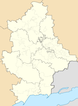 Talakivka Talakivka (Donetsk Oblast) | |
| Coordinates: 47°11′7″N 37°43′19″E | |
| Country | |
| Oblast (Province) | |
| Raion (District) | Mariupol Raion |
| Hromada | Sartana settlement hromada |
| Founded | 1889 |
| Area | |
| • Total | 2.39 km2 (0.92 sq mi) |
| Elevation | 6 m (20 ft) |
| Population (2022) | |
| • Total | 3,832 |
| • Density | 1,600/km2 (4,200/sq mi) |
| Time zone | UTC+2 (EET) |
| • Summer (DST) | UTC+3 (EEST) |
| Postal code | 87594-87595 |
| Area code | +380 629 |
Demographics
In 2001 the settlement had a population of 4160. Native language as of the Ukrainian Census of 2001:[2]
Dynamics of population has been as follows:[3]
| Year | Population |
|---|---|
| 1897 | 652 |
| 1959 | 2886 |
| 1970 | 3574 |
| 1979 | 4502 |
| 1987 | 4600 |
| 1988 | 4600 |
| 1989 | 3848 |
| 1992 | 3900 |
| 1998 | 3800 |
| 2001 | 4160 |
| 2004 | 4100 |
| 2009 | 4160 |
| 2010 | 4155 |
| 2011 | 4129 |
| 2012 | 4137 |
| 2013 | 4130 |
| 2014 | 4133 |
| 2015 | 4113 |
References
- Чисельність наявного населення України на 1 січня 2022 [Number of Present Population of Ukraine, as of January 1, 2022] (PDF) (in Ukrainian and English). Kyiv: State Statistics Service of Ukraine.
- Розподіл населення за рідною мовою на ukrcensus.gov.ua
- Населення міст та смт України
This article about a location in Donetsk Oblast is a stub. You can help Wikipedia by expanding it. |
На других языках
[de] Talakiwka
Talakiwka (ukrainisch Талаківка; russisch Талаковка .mw-parser-output .Latn{font-family:"Akzidenz Grotesk","Arial","Avant Garde Gothic","Calibri","Futura","Geneva","Gill Sans","Helvetica","Lucida Grande","Lucida Sans Unicode","Lucida Grande","Stone Sans","Tahoma","Trebuchet","Univers","Verdana"}Talakowka) ist eine Siedlung städtischen Typs in der Oblast Donezk im Osten der Ukraine mit etwa 4000 Einwohnern.- [en] Talakivka
[ru] Талаковка
Талако́вка — посёлок городского типа в Донецкой области Украины.[2] Административно подчинён Кальмиусскому району Мариуполя (в 18 км от центра города, в 11 км от ж/д станции «Мариуполь-Грузовой»). В подчинение Талаковского поссовета входят сёла Гнутово и Ломакино.Текст в блоке "Читать" взят с сайта "Википедия" и доступен по лицензии Creative Commons Attribution-ShareAlike; в отдельных случаях могут действовать дополнительные условия.
Другой контент может иметь иную лицензию. Перед использованием материалов сайта WikiSort.org внимательно изучите правила лицензирования конкретных элементов наполнения сайта.
Другой контент может иметь иную лицензию. Перед использованием материалов сайта WikiSort.org внимательно изучите правила лицензирования конкретных элементов наполнения сайта.
2019-2025
WikiSort.org - проект по пересортировке и дополнению контента Википедии
WikiSort.org - проект по пересортировке и дополнению контента Википедии