world.wikisort.org - Spain
Cruïlles, Monells i Sant Sadurní de l'Heura is a Spanish municipality of the Province of Girona, situated in the comarca (county) of Baix Empordà (Catalonia), formed in 1973 by merging the municipalities of Cruïlles, Monells, and Sant Sadurní de l'Heura. Sant Sadurní is the capital of the municipality. According to the 2014 census,[4] the municipality has a population of 1,284 inhabitants.
Cruïlles, Monells i Sant Sadurní de l'Heura | |
|---|---|
Municipality | |
 Church of Sant Sadurní de l'Heura (built 1773-1777). | |
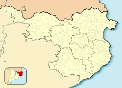 Cruïlles, Monells i Sant Sadurní de l'Heura Location in Catalonia  Cruïlles, Monells i Sant Sadurní de l'Heura Cruïlles, Monells i Sant Sadurní de l'Heura (Spain) | |
| Coordinates: 41°57′30″N 2°59′34″E | |
| Country | Spain |
| Community | Catalonia |
| Province | Girona |
| Comarca | Baix Empordà |
| Government | |
| • Mayor | Salvi Casas Camps (2015)[1] |
| Area | |
| • Total | 99.8 km2 (38.5 sq mi) |
| Elevation | 110 m (360 ft) |
| Population (2018)[3] | |
| • Total | 1,274 |
| • Density | 13/km2 (33/sq mi) |
| Website | cruilles |


The municipality has the longest toponym in Catalan at 43 characters.
Villages
| Populated place | Inhabitants |
|---|---|
| Veïnat del Rissec | 11 |
| Veïnat de Sies | 49 |
| Veïnat de Sant Joan | 3 |
| Veïnat de la Font, el | 12 |
| Veïnat de Banyeres | 31 |
| Veïnat d'Estravau | 4 |
| Santa Pellaia | 19 |
| Sant Sadurní de l'Heura | 174 |
| Sant Miquel de Cruïlles | 17 |
| Sant Joan de Salelles | 19 |
| Sant Cebrià dels Alls | 5 |
| Sant Cebrià de Lledó | 7 |
| Rabioses, les | 80 |
| Puigventós | 370 |
| Monells | 182 |
| Cruïlles | 250 |
| Barri del Mas Savalls | 0 |
Places of interest
- Monastery of Sant Miquel de Cruïlles
- Church of Sant Sadurní de l'Heura
- Church of Santa Eulalia de Cruïlles
- Keep of Cruïlles' Castle
- Church of Sant Genís de Monells
- Church of Sant Joan de Salelles
Demographics
| Year | Population |
|---|---|
| 1497 | 233 |
| 1515 | 187 |
| 1553 | 220 |
| 1717 | 1,222 |
| 1787 | 1,419 |
| 1857 | 2,664 |
| 1877 | 2,184 |
| 1887 | 2,173 |
| 1900 | 1,877 |
| 1910 | 1,861 |
| 1920 | 1,766 |
| 1930 | 1,600 |
| 1940 | 1,482 |
| 1950 | 1,444 |
| 1960 | 1,382 |
| 1970 | 1,152 |
| 1981 | 1,056 |
| 1990 | 1,031 |
| 1992 | 1,073 |
| 1994 | 1,088 |
| 1996 | 1,099 |
| 1998 | 1,071 |
| 2000 | 1,096 |
| 2002 | 1,150 |
| 2004 | 1,201 |
| 2006 | 1,271 |
| 2014 | 1,284 |
See also
References
- "Ajuntament de Cruïlles, Monells i Sant Sadurní de l'Heura". Generalitat of Catalonia. Retrieved 2015-11-13.
- "El municipi en xifres: Cruïlles, Monells i Sant Sadurní de l'Heura". Statistical Institute of Catalonia. Retrieved 2015-11-23.
- Municipal Register of Spain 2018. National Statistics Institute.
- Instituto Nacional de Estadística (INE)
External links
 Media related to Cruïlles, Monells i Sant Sadurní de l'Heura at Wikimedia Commons
- Government data pages (in Catalan)
Places adjacent to Cruïlles, Monells i Sant Sadurní de l'Heura | ||||||||||||||||
|---|---|---|---|---|---|---|---|---|---|---|---|---|---|---|---|---|
| ||||||||||||||||
Municipalities of Baix Empordà | ||
|---|---|---|
| ||
| Authority control |
|
|---|
На других языках
- [en] Cruïlles, Monells i Sant Sadurní de l'Heura
[es] Cruilles, Monells y San Sadurní
Cruilles, Monells y San Sadurní[1][2] (en catalán y oficialmente Cruïlles, Monells i Sant Sadurní de l'Heura) es un municipio español de la comarca del Bajo Ampurdán en la provincia de Gerona, Cataluña, formado en el año 1974 con la unión de los municipios de Cruilles, Monells y San Sadurní.[ru] Круильес-Монельс-и-Сан-Садурни-де-ла-Эура
Круйльес, Монельс-и-Сант-Садурни-де-ль’Еура (исп. Cruïlles, Monells i Sant Sadurní de l'Heura, баск. Cruilles, Monells i Sant Sadurni de l'Heura, кат. Cruïlles, Monells i Sant Sadurní de l'Heura) — муниципалитет в Испании, входит в провинцию Жирона в составе автономного сообщества Каталония. Муниципалитет находится в составе района (комарки) Баш-Эмпорда. Занимает площадь 99,83 км². Население — 1 250 человек (на 2010 год).Текст в блоке "Читать" взят с сайта "Википедия" и доступен по лицензии Creative Commons Attribution-ShareAlike; в отдельных случаях могут действовать дополнительные условия.
Другой контент может иметь иную лицензию. Перед использованием материалов сайта WikiSort.org внимательно изучите правила лицензирования конкретных элементов наполнения сайта.
Другой контент может иметь иную лицензию. Перед использованием материалов сайта WikiSort.org внимательно изучите правила лицензирования конкретных элементов наполнения сайта.
2019-2025
WikiSort.org - проект по пересортировке и дополнению контента Википедии
WikiSort.org - проект по пересортировке и дополнению контента Википедии