world.wikisort.org - Sudafrica
Keurboomstrand è una località costiera sudafricana situata nella municipalità distrettuale di Eden nella provincia del Capo Occidentale.
| Keurboomstrand città | |
|---|---|
 | |
| Localizzazione | |
| Stato | |
| Provincia | Capo Occidentale |
| Distretto | Eden |
| Municipalità locale | Bitou |
| Territorio | |
| Coordinate | 34°00′S 23°27′E |
| Altitudine | 12 m s.l.m. |
| Superficie | 9,75[1] km² |
| Abitanti | 475[2] (2011) |
| Densità | 48,72 ab./km² |
| Altre informazioni | |
| Cod. postale | 7130 |
| Prefisso | 044 |
| Fuso orario | UTC+2 |
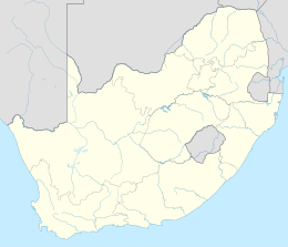
| Cartografia | |
Geografia fisica
Il piccolo centro abitato sorge presso la foce del fiume Keurbooms, dal quale prende il nome, a circa 6 chilometri a nord-est della città Plettenbergbaai.
Note
На других языках
[en] Keurboomstrand
Keurboomstrand is a resort town near Plettenberg Bay on the Western Cape of South Africa. It takes its name from the indigenous keurboom tree which grows in the region. The Keurbooms River runs nearby. It is commonly seen as a less busy alternative to Plettenberg Bay for holiday goers and is said to be family frienly. Seen as a safe space with a laid back atmosphere.- [it] Keurboomstrand
Текст в блоке "Читать" взят с сайта "Википедия" и доступен по лицензии Creative Commons Attribution-ShareAlike; в отдельных случаях могут действовать дополнительные условия.
Другой контент может иметь иную лицензию. Перед использованием материалов сайта WikiSort.org внимательно изучите правила лицензирования конкретных элементов наполнения сайта.
Другой контент может иметь иную лицензию. Перед использованием материалов сайта WikiSort.org внимательно изучите правила лицензирования конкретных элементов наполнения сайта.
2019-2025
WikiSort.org - проект по пересортировке и дополнению контента Википедии
WikiSort.org - проект по пересортировке и дополнению контента Википедии
