world.wikisort.org - Russia
Boguchany (Russian: Богучаны) is a rural locality (a selo) and the administrative center of the Boguchansky District of Krasnoyarsk Krai, Russia, located on the left bank of the Angara River. Population: 11,232 (2010 Census);[1] 11,386 (2002 Census);[4] 14,433 (1989 Census).[5]
Boguchany
Богучаны | |
|---|---|
Selo[1] | |
 View of Boguchany from a Helicopter | |
 Flag  Coat of arms | |
Location of Boguchany  | |
 Boguchany Location of Boguchany 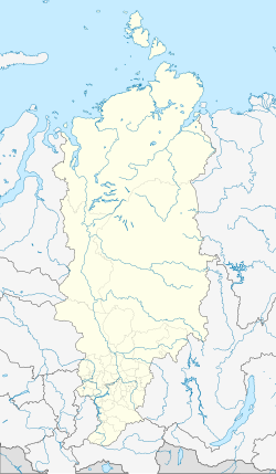 Boguchany Boguchany (Krasnoyarsk Krai) | |
| Coordinates: 58°22′N 97°27′E | |
| Country | Russia |
| Federal subject | Krasnoyarsk Krai[1] |
| Administrative district | Boguchansky District[1] |
| Founded | 1642 |
| Elevation | 131 m (430 ft) |
| Population | |
| • Total | 11,232 |
Administrative status | |
| • Capital of | Boguchansky District[1] |
| Time zone | UTC+7 (MSK+4 |
| Postal code(s)[3] | 663430 |
| OKTMO ID | 04609410101 |
Transportation
Boguchany is served by the Boguchany Airport.[6]
Climate
Boguchany has a subarctic climate (Köppen climate classification Dfc) with severely cold winters and warm summers. Precipitation is quite low, but is somewhat higher from June to September than at other times of the year.
| Climate data for Boguchany | |||||||||||||
|---|---|---|---|---|---|---|---|---|---|---|---|---|---|
| Month | Jan | Feb | Mar | Apr | May | Jun | Jul | Aug | Sep | Oct | Nov | Dec | Year |
| Record high °C (°F) | 4.3 (39.7) |
7.6 (45.7) |
18.0 (64.4) |
31.0 (87.8) |
34.6 (94.3) |
37.7 (99.9) |
37.1 (98.8) |
35.1 (95.2) |
30.6 (87.1) |
23.9 (75.0) |
12.8 (55.0) |
5.1 (41.2) |
37.7 (99.9) |
| Average high °C (°F) | −18.5 (−1.3) |
−13.3 (8.1) |
−2.1 (28.2) |
6.3 (43.3) |
15.7 (60.3) |
22.8 (73.0) |
25.8 (78.4) |
22.2 (72.0) |
13.5 (56.3) |
3.8 (38.8) |
−7.7 (18.1) |
−16.3 (2.7) |
4.4 (39.9) |
| Daily mean °C (°F) | −23.3 (−9.9) |
−19.6 (−3.3) |
−9.6 (14.7) |
0.0 (32.0) |
8.4 (47.1) |
15.9 (60.6) |
19.1 (66.4) |
15.7 (60.3) |
8.1 (46.6) |
−0.2 (31.6) |
−11.5 (11.3) |
−20.7 (−5.3) |
−1.5 (29.3) |
| Average low °C (°F) | −27.6 (−17.7) |
−24.8 (−12.6) |
−16.1 (3.0) |
−5.5 (22.1) |
2.2 (36.0) |
9.7 (49.5) |
13.2 (55.8) |
10.3 (50.5) |
4.1 (39.4) |
−3.3 (26.1) |
−14.9 (5.2) |
−24.8 (−12.6) |
−6.5 (20.3) |
| Record low °C (°F) | −53.5 (−64.3) |
−51.7 (−61.1) |
−43.9 (−47.0) |
−32.8 (−27.0) |
−14.7 (5.5) |
−5.3 (22.5) |
1.8 (35.2) |
−1.9 (28.6) |
−9.4 (15.1) |
−28.3 (−18.9) |
−48.7 (−55.7) |
−51.4 (−60.5) |
−53.5 (−64.3) |
| Average precipitation mm (inches) | 16 (0.6) |
13 (0.5) |
12 (0.5) |
20 (0.8) |
29 (1.1) |
45 (1.8) |
52 (2.0) |
50 (2.0) |
45 (1.8) |
31 (1.2) |
27 (1.1) |
21 (0.8) |
361 (14.2) |
| Average rainy days | 0.3 | 0.2 | 2 | 10 | 17 | 18 | 15 | 16 | 18 | 14 | 3 | 0.3 | 114 |
| Average snowy days | 24 | 22 | 18 | 14 | 5 | 0.3 | 0 | 0.1 | 3 | 18 | 25 | 25 | 154 |
| Average relative humidity (%) | 79 | 76 | 70 | 61 | 58 | 63 | 67 | 72 | 74 | 74 | 78 | 79 | 71 |
| Mean monthly sunshine hours | 30 | 87 | 164 | 212 | 243 | 278 | 292 | 223 | 142 | 79 | 43 | 14 | 1,807 |
| Source 1: Pogoda.ru.net[7] | |||||||||||||
| Source 2: NOAA (sun, 1961–1990)[8] | |||||||||||||
References
- Russian Federal State Statistics Service (2011). Всероссийская перепись населения 2010 года. Том 1 [2010 All-Russian Population Census, vol. 1]. Всероссийская перепись населения 2010 года [2010 All-Russia Population Census] (in Russian). Federal State Statistics Service.
- "Об исчислении времени". Официальный интернет-портал правовой информации (in Russian). June 3, 2011. Retrieved January 19, 2019.
- Почта России. Информационно-вычислительный центр ОАСУ РПО. (Russian Post). Поиск объектов почтовой связи (Postal Objects Search) (in Russian)
- Russian Federal State Statistics Service (May 21, 2004). Численность населения России, субъектов Российской Федерации в составе федеральных округов, районов, городских поселений, сельских населённых пунктов – районных центров и сельских населённых пунктов с населением 3 тысячи и более человек [Population of Russia, Its Federal Districts, Federal Subjects, Districts, Urban Localities, Rural Localities—Administrative Centers, and Rural Localities with Population of Over 3,000] (XLS). Всероссийская перепись населения 2002 года [All-Russia Population Census of 2002] (in Russian).
- Всесоюзная перепись населения 1989 г. Численность наличного населения союзных и автономных республик, автономных областей и округов, краёв, областей, районов, городских поселений и сёл-райцентров [All Union Population Census of 1989: Present Population of Union and Autonomous Republics, Autonomous Oblasts and Okrugs, Krais, Oblasts, Districts, Urban Settlements, and Villages Serving as District Administrative Centers]. Всесоюзная перепись населения 1989 года [All-Union Population Census of 1989] (in Russian). Институт демографии Национального исследовательского университета: Высшая школа экономики [Institute of Demography at the National Research University: Higher School of Economics]. 1989 – via Demoscope Weekly.
- "Boguchany Airport". OurAirports. Retrieved January 23, 2013.
- "Weather and Climate- The Climate of Boguchany" (in Russian). Weather and Climate (Погода и климат). Retrieved May 15, 2015.
- "Bogucany (Boguchany) Climate Normals 1961–1990". National Oceanic and Atmospheric Administration. Retrieved May 15, 2015.
На других языках
[de] Bogutschany
Bogutschany (russisch Богуча́ны) ist ein Dorf in der Region Krasnojarsk (Russland) mit 11.232 Einwohnern (Stand 14. Oktober 2010).[1]- [en] Boguchany (rural locality)
[ru] Богучаны
Богуча́ны (от эвенкийского «букачан» — «бугор», «холм», «остров»[3]) — село, административный центр Богучанского района Красноярского края.Текст в блоке "Читать" взят с сайта "Википедия" и доступен по лицензии Creative Commons Attribution-ShareAlike; в отдельных случаях могут действовать дополнительные условия.
Другой контент может иметь иную лицензию. Перед использованием материалов сайта WikiSort.org внимательно изучите правила лицензирования конкретных элементов наполнения сайта.
Другой контент может иметь иную лицензию. Перед использованием материалов сайта WikiSort.org внимательно изучите правила лицензирования конкретных элементов наполнения сайта.
2019-2025
WikiSort.org - проект по пересортировке и дополнению контента Википедии
WikiSort.org - проект по пересортировке и дополнению контента Википедии