world.wikisort.org - Russia
Amderma (Russian: Амдерма, lit. a walrus rookery in Nenets) is a rural locality (a settlement) in Zapolyarny District of Nenets Autonomous Okrug, Russia, located on the coast of Kara Sea, near the Vaygach Island, 490 kilometers (300 mi) from Naryan-Mar, the administrative center of the autonomous okrug. Population: 541 (2010 Census);[1] 647 (2002 Census)[4].
Amderma
Амдерма | |
|---|---|
City/town | |
 | |
 Flag  Coat of arms | |
Location of Amderma  | |
 Amderma Location of Amderma 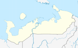 Amderma Amderma (Nenets Autonomous Okrug) | |
| Coordinates: | |
| Country | Russia |
| Federal subject | Nenets Autonomous Okrug |
| Founded | 1933 |
| Elevation | 20 m (70 ft) |
| Population | |
| • Total | 541 |
| • Estimate (2021) | 506 |
| Time zone | UTC+3 (MSK |
| Postal code(s)[3] | 166744 |
| OKTMO ID | 11811464101 |

History
It was established in 1933.[citation needed] Previously an urban-type settlement, it was demoted to a rural locality in November 2005, but its rural status was not officially codified until a law to that effect was passed in April 2015.[citation needed]
Climate
Amderma has a polar climate (ET) with very cool and short summers combined with very long and cold (but by Russian standards not severe) winters. Although relative winter temperatures are normally hovering around −20 °C (−4 °F), the transition months of May and October see a milder form of winter. As a result of the lack of regular warm temperatures Amderma is above the tree line. It experiences midnight sun and polar night. However, the cold Arctic Ocean tempers and reduces the heat effect midnight sun brings to inland locations further south such as Naryan-Mar. Brief warm temperatures have been recorded when southerly winds have reached the area with a July record high of 31.8 °C (89.2 °F). Winters are very cold for a marine location, but in spite of this there are several marine localities at lower parallels in North America that experience colder January lows than Amderma.
| Climate data for Amderma (1991–2020, extremes 1934–present) | |||||||||||||
|---|---|---|---|---|---|---|---|---|---|---|---|---|---|
| Month | Jan | Feb | Mar | Apr | May | Jun | Jul | Aug | Sep | Oct | Nov | Dec | Year |
| Record high °C (°F) | 1.6 (34.9) |
1.5 (34.7) |
3.5 (38.3) |
7.6 (45.7) |
20.3 (68.5) |
28.0 (82.4) |
31.8 (89.2) |
28.8 (83.8) |
21.4 (70.5) |
11.7 (53.1) |
4.3 (39.7) |
4.9 (40.8) |
31.8 (89.2) |
| Average high °C (°F) | −13.8 (7.2) |
−14.3 (6.3) |
−10.6 (12.9) |
−6.3 (20.7) |
−1.0 (30.2) |
6.3 (43.3) |
11.9 (53.4) |
10.6 (51.1) |
6.9 (44.4) |
0.3 (32.5) |
−6.3 (20.7) |
−10.0 (14.0) |
−2.2 (28.0) |
| Daily mean °C (°F) | −17.3 (0.9) |
−17.7 (0.1) |
−14.1 (6.6) |
−9.7 (14.5) |
−3.6 (25.5) |
3.0 (37.4) |
8.0 (46.4) |
7.7 (45.9) |
4.5 (40.1) |
−1.9 (28.6) |
−9.2 (15.4) |
−13.4 (7.9) |
−5.3 (22.5) |
| Average low °C (°F) | −21.1 (−6.0) |
−21.3 (−6.3) |
−17.5 (0.5) |
−13.1 (8.4) |
−6.0 (21.2) |
0.5 (32.9) |
4.7 (40.5) |
5.3 (41.5) |
2.2 (36.0) |
−4.4 (24.1) |
−12.5 (9.5) |
−17.0 (1.4) |
−8.3 (17.1) |
| Record low °C (°F) | −42.4 (−44.3) |
−44.6 (−48.3) |
−43.1 (−45.6) |
−33.9 (−29.0) |
−26.0 (−14.8) |
−9.5 (14.9) |
−4.4 (24.1) |
−3.3 (26.1) |
−9.7 (14.5) |
−27.7 (−17.9) |
−34.9 (−30.8) |
−39.7 (−39.5) |
−44.6 (−48.3) |
| Average precipitation mm (inches) | 29 (1.1) |
21 (0.8) |
21 (0.8) |
22 (0.9) |
27 (1.1) |
39 (1.5) |
49 (1.9) |
47 (1.9) |
46 (1.8) |
50 (2.0) |
36 (1.4) |
30 (1.2) |
417 (16.4) |
| Source: Pogoda.ru.net[5] | |||||||||||||
Economy
Fluorite deposits are located in the vicinity of Amderma, but the mines have been abandoned since the 1990s.[6] It is home to the Amderma Airport, a civil airport and military base.
References
- Russian Federal State Statistics Service (2011). Всероссийская перепись населения 2010 года. Том 1 [2010 All-Russian Population Census, vol. 1]. Всероссийская перепись населения 2010 года [2010 All-Russia Population Census] (in Russian). Federal State Statistics Service.
- "Об исчислении времени". Официальный интернет-портал правовой информации (in Russian). 3 June 2011. Retrieved 19 January 2019.
- Почта России. Информационно-вычислительный центр ОАСУ РПО. (Russian Post). Поиск объектов почтовой связи (Postal Objects Search) (in Russian)
- Russian Federal State Statistics Service (21 May 2004). Численность населения России, субъектов Российской Федерации в составе федеральных округов, районов, городских поселений, сельских населённых пунктов – районных центров и сельских населённых пунктов с населением 3 тысячи и более человек [Population of Russia, Its Federal Districts, Federal Subjects, Districts, Urban Localities, Rural Localities—Administrative Centers, and Rural Localities with Population of Over 3,000] (XLS). Всероссийская перепись населения 2002 года [All-Russia Population Census of 2002] (in Russian).
- "Climate of Amderma" (in Russian). Weather and Climate (Погода и климат). Retrieved 19 November 2021.
- "Двина-Информ | Новости | Амдерме - быть!". www.dvinainform.ru. Retrieved 2016-01-07.
External links
- An article about Amderma at sevmeteo.ru (in Russian)
На других языках
- [en] Amderma
[ru] Амдерма
А́мдерма — посёлок (в 1936—2015 годах — рабочий посёлок[2]) в Заполярном районе Ненецкого автономного округа. Образует административно-территориальную единицу (посёлок) и сельское поселение посёлок Амдерма[3][4].Другой контент может иметь иную лицензию. Перед использованием материалов сайта WikiSort.org внимательно изучите правила лицензирования конкретных элементов наполнения сайта.
WikiSort.org - проект по пересортировке и дополнению контента Википедии