world.wikisort.org - Mexico
Namiquipa is one of the 67 municipalities of Chihuahua, in northern Mexico. The municipal seat lies at Namiquipa.
Namiquipa | |
|---|---|
Municipality | |
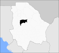 Municipality of Namiquipa in Chihuahua | |
Namiquipa Location in Mexico | |
| Coordinates: 29°15′01″N 107°24′33″W | |
| Country | |
| State | Chihuahua |
| Municipal seat | Namiquipa |
| Municipality created | 21 November 1844 |
| Government | |
| • Municipal President | Héctor Ariel Meixueiro Muñoz (PRI) |
| Area | |
| • Total | 4,212.58 km2 (1,626.49 sq mi) |
| Elevation | 1,888 m (6,194 ft) |
| Population (2010) | |
| • Total | 22,880 |
| • Density | 5.4/km2 (14/sq mi) |
| Demonym | Namiquipense |
| Website | www.namiquipa.gob.mx |
As of 2010, the municipality had a total population of 22,880,[1] up from 20,314 as of 2005.[2]
As of 2010, the town of Namiquipa had a population of 1,752,[1] up from 1,718 as of 2005.[3] Other than the town of Namiquipa, the municipality had 363 localities, the largest of which (with 2010 populations in parentheses) were: Santa Ana (2,978), classified as urban, and El Terrero (2,621), El Molino (2,176), Benito Juárez (1,967), classified as urban, and Cruces (1,206), and Independencia (Cologachi) (1,088), classified as rural.[1]
References
- "Namiquipa". Catálogo de Localidades. Secretaría de Desarrollo Social (SEDESOL). Retrieved 23 April 2014.
- "Namiquipa". Enciclopedia de los Municipios de México. Instituto Nacional para el Federalismo y el Desarrollo Municipal. Archived from the original on May 29, 2007. Retrieved October 13, 2008.
- "Namiquipa". Enciclopedia de los Municipios de México. Instituto Nacional para el Federalismo y el Desarrollo Municipal. Archived from the original on May 29, 2007. Retrieved October 13, 2008.
Chihuahua (capital) | ||
| Cities |
|  |
| Municipalities |
| |
| Metropolitan areas |
| |
| History |
| |
| Sights |
| |
| Other topics |
| |
This article about a location in the Mexican state of Chihuahua is a stub. You can help Wikipedia by expanding it. |
На других языках
- [en] Namiquipa Municipality
[ru] Намикипа (муниципалитет)
Намикипа (исп. Namiquipa) — муниципалитет в Мексике, штат Чиуауа с административным центром в одноимённом посёлке. Численность населения, по данным переписи 2010 года, составила 22 880 человек.Другой контент может иметь иную лицензию. Перед использованием материалов сайта WikiSort.org внимательно изучите правила лицензирования конкретных элементов наполнения сайта.
WikiSort.org - проект по пересортировке и дополнению контента Википедии