world.wikisort.org - India
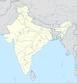
Palakkad è un distretto dell'India di 2.617.072 abitanti, che ha come capoluogo Palakkad.
| Distretto di Palakkad distretto | |
|---|---|
| Palakkad District | |
| Localizzazione | |
| Stato | |
| Stato federato | Kerala |
| Divisione | Non presente |
| Amministrazione | |
| Capoluogo | Palakkad |
| Territorio | |
| Coordinate del capoluogo | 10°46′59.88″N 76°39′00″E |
| Superficie | 4 480 km² |
| Abitanti | 2 617 072 (2001) |
| Densità | 584,17 ab./km² |
| Altre informazioni | |
| Fuso orario | UTC+5:30 |
| Cartografia | |
| Sito istituzionale | |
Altri progetti
 Wikimedia Commons contiene immagini o altri file su distretto di Palakkad
Collegamenti esterni
- Sito ufficiale, su palakkad.nic.in.
| Controllo di autorità | VIAF (EN) 241191659 · GND (DE) 5095201-8 |
|---|
На других языках
[de] Palakkad (Distrikt)
Der Distrikt Palakkad (Malayalam: പാലക്കാട് ജില്ല, früher Palghat) ist ein Distrikt im südindischen Bundesstaat Kerala. Verwaltungssitz ist die namensgebende Stadt Palakkad.[en] Palakkad district
Palakkad District (Malayalam: [pɐːlɐkːɐːɖɨ̆] (listen)) is one of the 14 districts in the Indian state of Kerala. It was carved out from the southeastern region of the former Malabar District on 1 January 1957. It is located at the centre of Kerala. It is the largest district in the state since 2006. The city of Palakkad is the district headquarters. Palakkad is bordered on the northwest by the Malappuram district, on the southwest by the Thrissur district, on the northeast by Nilgiris district, and on the east by Coimbatore district of Tamil Nadu. The district is nicknamed "The granary of Kerala". Palakkad is the gateway to Kerala due to the presence of the Palakkad Gap, in the Western Ghats. The 2,383 m high Anginda peak, which is situated in the border of Palakkad district, Nilgiris district, and Malappuram district, in Silent Valley National Park, is the highest point of elevation in Palakkad district. Palakkad city is located just 50 km away from Coimbatore, a major city in Tamil Nadu state.- [it] Distretto di Palakkad
[ru] Палгхат (округ)
Палгха́т (малаял. പാലക്കാട് ജില്ല; англ. Palakkad) — округ в индийском штате Керала. Образован 1 января 1957 года. Административный центр — город Палгхат. Площадь округа — 4480 км². В административном отношении делится на 5 талуков: Алатхур, Читтур, Маннарккад, Оттаппалам и Палгхат.Текст в блоке "Читать" взят с сайта "Википедия" и доступен по лицензии Creative Commons Attribution-ShareAlike; в отдельных случаях могут действовать дополнительные условия.
Другой контент может иметь иную лицензию. Перед использованием материалов сайта WikiSort.org внимательно изучите правила лицензирования конкретных элементов наполнения сайта.
Другой контент может иметь иную лицензию. Перед использованием материалов сайта WikiSort.org внимательно изучите правила лицензирования конкретных элементов наполнения сайта.
2019-2025
WikiSort.org - проект по пересортировке и дополнению контента Википедии
WikiSort.org - проект по пересортировке и дополнению контента Википедии
