world.wikisort.org - India
Banihal è una città dell'India di 2.729 abitanti, situata nel distretto di Doda, nel territorio del Jammu e Kashmir. In base al numero di abitanti la città rientra nella classe VI (meno di 5.000 persone)[4].
| Banihal Commissione d'Area Pianificata (Notified Area Committee) | |
|---|---|
 | |
| Localizzazione | |
| Stato | |
| Stato federato | |
| Divisione | Jammu |
| Distretto | Doda |
| Territorio | |
| Coordinate | 33°25′12″N 75°12′00″E |
| Altitudine | 1 665[1] m s.l.m. |
| Abitanti | 2 729 (2001) |
| Altre informazioni | |
| Lingue | kashmiri, inglese |
| Cod. postale | 182146[2] |
| Prefisso | 1998[3] |
| Fuso orario | UTC+5:30 |
| Cartografia | |
 Banihal | |
Geografia fisica
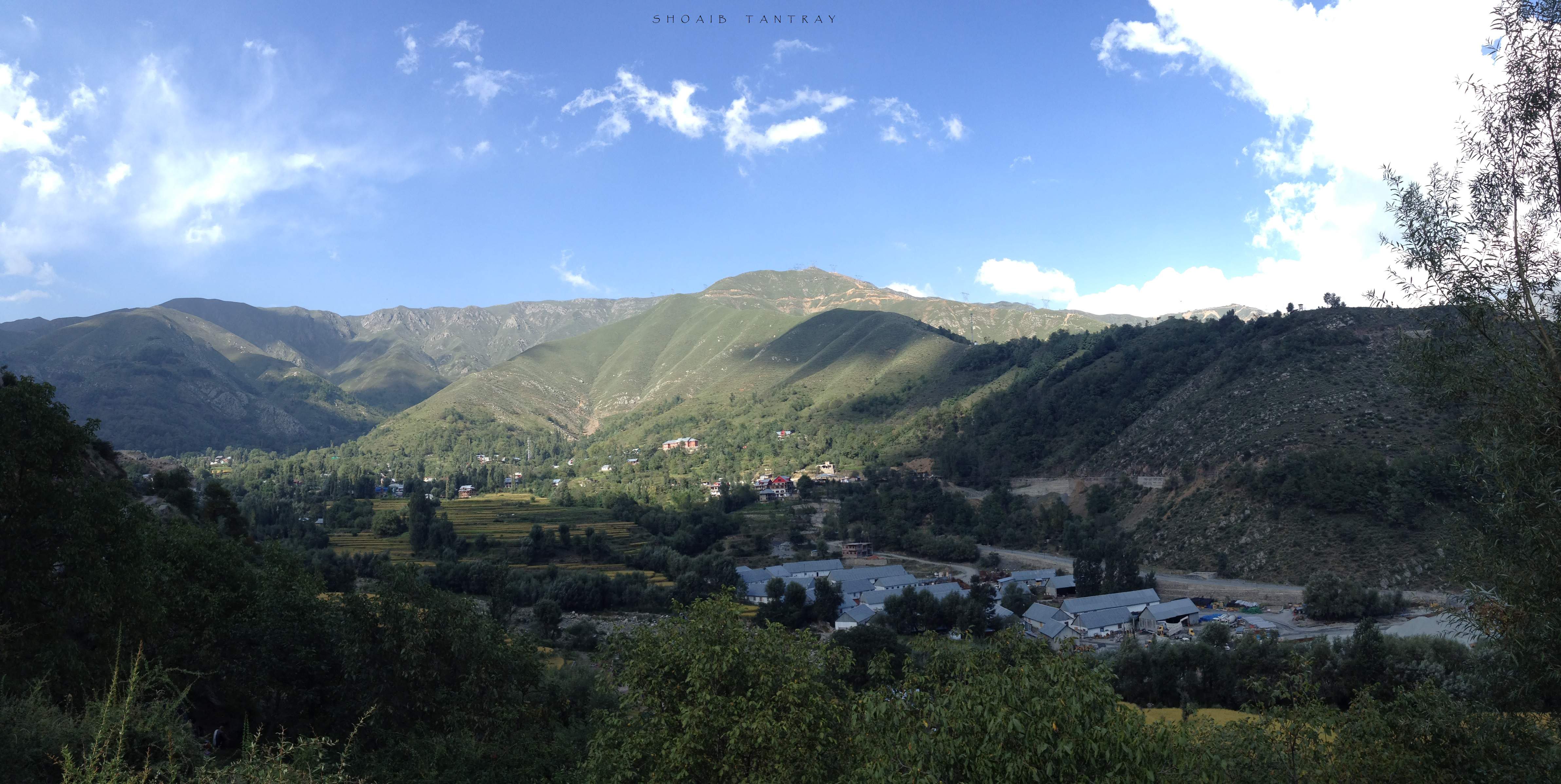
La città è situata a 33° 25' 0 N e 75° 12' 0 E e ha un'altitudine di 1.665 m s.l.m.[1].
Società
Evoluzione demografica
Al censimento del 2001 la popolazione di Banihal assommava a 2.729 persone, delle quali 1.564 maschi e 1.165 femmine. I bambini di età inferiore o uguale ai sei anni assommavano a 320, dei quali 180 maschi e 140 femmine. Infine, coloro che erano in grado di saper almeno leggere e scrivere erano 1.869, dei quali 1.228 maschi e 641 femmine.[5]
Note
- (EN) Falling Rain Genomics, Inc, Banihal, India Page, su fallingrain.com. URL consultato l'11 luglio 2008.
- (EN) India Post, Pincode search - Banihal [collegamento interrotto], su indiapost.gov.in. URL consultato il 28 luglio 2008.
- (EN) Indiacom, STD Code list for City : B, su indiacom.com. URL consultato il 10 agosto 2008.
- Census of India, Alphabetical list of towns and their population - Jammu and Kashmir (PDF), su censusindia.gov.in. URL consultato il 21 maggio 2008.
- (EN) Census of India 2001, Population, population in the age group 0-6 and literates by sex - Cities/Towns (in alphabetic order): 2001, su censusindia.net. URL consultato il 20 giugno 2008 (archiviato dall'url originale il 16 giugno 2004).
Altri progetti
 Wikimedia Commons contiene immagini o altri file su Banihal
На других языках
[en] Banihal
Banihal (Urdu pronunciation: [bɑːnɪɦɑːl]) is a town and a notified area committee, near Ramban town in Ramban district in the Indian union territory of Jammu and Kashmir. It is a rural and hilly area with Kamirwah being one of the most prominent hills. It is located about 35 km (22 mi) away from Qazigund of Anantnag district on NH 44 (former name NH 1A before renumbering of all national highways). However, the distance between Banihal and Qazigund is only 18 km by train on the new railway line which is much shorter than the road. The most common language spoken in the region is Kashmiri; Urdu, Hindi, Gujjari, Pahari and English being other familiar languages. Banihal forms the main gateway to the valley of Kashmir.- [it] Banihal
Текст в блоке "Читать" взят с сайта "Википедия" и доступен по лицензии Creative Commons Attribution-ShareAlike; в отдельных случаях могут действовать дополнительные условия.
Другой контент может иметь иную лицензию. Перед использованием материалов сайта WikiSort.org внимательно изучите правила лицензирования конкретных элементов наполнения сайта.
Другой контент может иметь иную лицензию. Перед использованием материалов сайта WikiSort.org внимательно изучите правила лицензирования конкретных элементов наполнения сайта.
2019-2025
WikiSort.org - проект по пересортировке и дополнению контента Википедии
WikiSort.org - проект по пересортировке и дополнению контента Википедии