world.wikisort.org - India
Udhranpur is a village in Shahabad block of Hardoi district, Uttar Pradesh, India.[2] It is located a bit north of Shahabad on the main Hardoi-Shahjahanpur road, just to the east of the river Garra.[3] The village hosts a periodic haat and has several schools and one clinic.[3] As of 2011, its population is 5,021, in 982 households.[2]
Udhranpur | |
|---|---|
Populated place | |
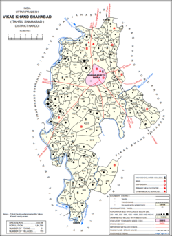 Map showing Udhranpur (#149) in Shahabad block | |
 Udhranpur Location in Uttar Pradesh, India  Udhranpur Udhranpur (India) | |
| Coordinates: 27.693293°N 79.928433°E[1] | |
| Country | |
| State | Uttar Pradesh |
| District | Hardoi |
| Area | |
| • Total | 6.297 km2 (2.431 sq mi) |
| Population (2011)[2] | |
| • Total | 5,021 |
| • Density | 800/km2 (2,100/sq mi) |
| Languages | |
| • Official | Hindi |
| Time zone | UTC+5:30 (IST) |
History
Around the turn of the 20th century, Udhranpur was described as a large village in the pargana and tehsil of Shahabad.[3] Its population as of the 1901 Census was 1,985 people, including 115 Muslims and 144 Christians, and a large Brahmin community among the Hindu majority.[3] The village was held in zamindari tenure and hosted markets twice a week, and there was a post office and large upper primary school.[3] The local indigo factory, formerly owned by Europeans, had by that point come under the joint ownership of Pandit Lajja Ram and other local Brahmin proprietors.[3]
References
- Search for "Udhranpur" here https://geonames.nga.mil/namesgaz/.
{{cite web}}: Missing or empty|title=(help) - "Census of India 2011: Uttar Pradesh District Census Handbook - Hardoi, Part A (Village and Town Directory)" (PDF). Census 2011 India. pp. 69–98. Retrieved 17 May 2021.
- Nevill, H.R. (1904). Hardoi - A Gazetteer. Allahabad: Government Press. p. 275. Retrieved 17 May 2021.
This Hardoi district location article is a stub. You can help Wikipedia by expanding it. |
Другой контент может иметь иную лицензию. Перед использованием материалов сайта WikiSort.org внимательно изучите правила лицензирования конкретных элементов наполнения сайта.
WikiSort.org - проект по пересортировке и дополнению контента Википедии