world.wikisort.org - Islanda
Rangárþing eystra è un comune islandese della regione di Suðurland, tra Eystri Rangá a ovest e Jökulsá á Sólheimasandi a est. I più grandi insediamenti sono Skógar e Hvolsvöllur.
| Rangárþing eystra comune | ||
|---|---|---|
| ||
 | ||
| Localizzazione | ||
| Stato | ||
| Regione | Suðurland | |
| Contea | Rangárvallasýsla | |
| Territorio | ||
| Coordinate | 63°45′00″N 20°14′02.4″W | |
| Superficie | 1 841 km² | |
| Abitanti | 1 741[1] (2011) | |
| Densità | 0,95 ab./km² | |
| Altre informazioni | ||
| Cod. postale | 860, 861 | |
| Fuso orario | UTC+0 | |
| Distretto elettorale | Suðurkjördæmi | |
| Cartografia | ||
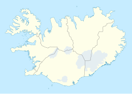 Rangárþing eystra | ||
 | ||
| Sito istituzionale | ||

Note
- (EN) Popolazione dei comuni islandesi, su statice.is, Statistics Iceland. URL consultato il 10 giugno 2012 (archiviato dall'url originale il 17 aprile 2012).
Collegamenti esterni
- Sito ufficiale, su hvolsvollur.is.
| Controllo di autorità | VIAF (EN) 8675152140008411100007 |
|---|
На других языках
[de] Rangárþing eystra
Rangárþing eystra ist eine isländische Gemeinde in der Region Suðurland. Am 1. Januar 2022 hatte die Gemeinde 1971 Einwohner.- [it] Rangárþing eystra
Текст в блоке "Читать" взят с сайта "Википедия" и доступен по лицензии Creative Commons Attribution-ShareAlike; в отдельных случаях могут действовать дополнительные условия.
Другой контент может иметь иную лицензию. Перед использованием материалов сайта WikiSort.org внимательно изучите правила лицензирования конкретных элементов наполнения сайта.
Другой контент может иметь иную лицензию. Перед использованием материалов сайта WikiSort.org внимательно изучите правила лицензирования конкретных элементов наполнения сайта.
2019-2025
WikiSort.org - проект по пересортировке и дополнению контента Википедии
WikiSort.org - проект по пересортировке и дополнению контента Википедии