world.wikisort.org - Allemagne
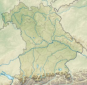
Hochstadt am Main est une commune de Bavière (Allemagne), située dans l'arrondissement de Lichtenfels, dans le district de Haute-Franconie.
| Hochstadt am Main Hochstadt a.Main | |

| |
 Armoiries |
|
| Administration | |
|---|---|
| Pays | |
| Land | |
| District (Regierungsbezirk) |
Haute-Franconie |
| Arrondissement (Landkreis) |
Lichtenfels |
| Nombre de quartiers (Ortsteile) |
9 |
| Code postal | 96272 |
| Indicatif téléphonique | 09574 |
| Immatriculation | LIF |
| Démographie | |
| Population | 1 650 hab. () |
| Densité | 120 hab./km2 |
| Géographie | |
| Coordonnées | 50° 08′ 00″ nord, 11° 10′ 00″ est |
| Altitude | 281 m |
| Superficie | 1 378 ha = 13,78 km2 |
| Localisation | |
| Liens | |
| Site web | www.hochstadt-main.de |
| modifier |
|
Notes et références
Liens externes
- Portail de la Bavière
На других языках
[de] Hochstadt am Main
Hochstadt am Main (amtlich Hochstadt a.Main) ist eine Gemeinde im oberfränkischen Landkreis Lichtenfels.[en] Hochstadt am Main
Hochstadt am Main is a municipality in the district of Lichtenfels in Bavaria in Germany. It lies on the river Main.- [fr] Hochstadt am Main
[ru] Хохштадт-ам-Майн
Хохштадт-ам-Майн (нем. Hochstadt am Main) — община в Германии, в земле Бавария.Текст в блоке "Читать" взят с сайта "Википедия" и доступен по лицензии Creative Commons Attribution-ShareAlike; в отдельных случаях могут действовать дополнительные условия.
Другой контент может иметь иную лицензию. Перед использованием материалов сайта WikiSort.org внимательно изучите правила лицензирования конкретных элементов наполнения сайта.
Другой контент может иметь иную лицензию. Перед использованием материалов сайта WikiSort.org внимательно изучите правила лицензирования конкретных элементов наполнения сайта.
2019-2025
WikiSort.org - проект по пересортировке и дополнению контента Википедии
WikiSort.org - проект по пересортировке и дополнению контента Википедии

