world.wikisort.org - Canada
Pemberton est un village du district régional de Squamish-Lillooet, dont il est le siège, en Colombie-Britannique au Canada. Il se situe dans la chaîne Côtière, plus précisément la vallée de Pemberton, au nord de Whistler et Vancouver.
Pour les articles homonymes, voir Pemberton.
| Pemberton | ||||

| ||||
| Administration | ||||
|---|---|---|---|---|
| Pays | ||||
| Province | ||||
| Subdivision régionale | District régional de Squamish-Lillooet | |||
| Statut municipal | Village | |||
| Maire | www.pemberton.ca/ | |||
| Démographie | ||||
| Population | 2 574 hab. (2016) | |||
| Densité | 236 hab./km2 | |||
| Géographie | ||||
| Coordonnées | 50° 19′ 13″ nord, 122° 48′ 18″ ouest | |||
| Superficie | 1 089 ha = 10,89 km2 | |||
| Divers | ||||
| Langue(s) | Anglais | |||
| Fuseau horaire | UTC-8 | |||
| Localisation | ||||
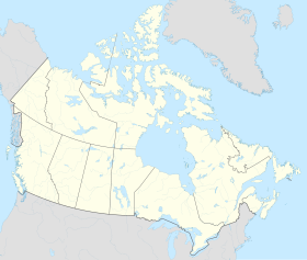
| Géolocalisation sur la carte : Canada
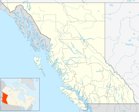
Géolocalisation sur la carte : Colombie-Britannique
Géolocalisation sur la carte : Colombie-Britannique
| ||||
| Liens | ||||
| Site web | www.pemberton.ca | |||
| modifier |
||||

Démographie
Toponymie
La commune est nommée d'après Joseph Despard Pemberton, gouverneur de la colonie de l'Île de Vancouver de 1849 à 1866.
Historique
Située sur le territoire traditionnel de la Nation Lil'wat, la région est progressivement explorée par la Compagnie de la Baie d'Hudson[3]. L'exploitation minière qui découle de la ruée vers l'or du canyon du Fraser entraîne les premières installations d'Européens, favorisées ensuite par le chemin de fer construit au début du XXe siècle. Pemberton devient une municipalité de Colombie-Britannique en 1956[4].
Accès
Pemberton est desservi par le chemin de fer et l'autoroute provinciale 99.
Références
- « Statistique Canada - Profils des communautés de 2006 - Pemberton » (consulté le )
- « Statistique Canada - Profils des communautés de 2016 - Pemberton » (consulté le )
- (en) Akihiko Nemoto et Yutaka Ishii, « Emerging Issues on Aboriginal Property Rights:Institutional Arrangement and Authority Formation in the Lil'watNation, Canada », Research Bulletin of Hokkaido University Forests, vol. 56, no 2, , p. 28-102
- (en) « Municipality: Pemberton (Village) », sur www.civicinfo.bc.ca (consulté le )
Bibliographie
- (en) Frances Decker, Margaret Fougberg, Mary Ronayne et Gordon Raymond Elliott, Pemberton: the history of a settlement, Pemberton Pioneer Women, (OCLC 4689455, lire en ligne).
 Portail de la Colombie-Britannique
На других языках
[de] Pemberton (British Columbia)
Pemberton ist ein Ort mit rund 2.500 Einwohnern in der kanadischen Provinz British Columbia. Er liegt im Tal des Pemberton River unterhalb des Mount Currie, im Squamish-Lillooet Regional District. Er ist Verwaltungssitz der St'at'imc oder Lilwat Nation.[en] Pemberton, British Columbia
Pemberton is a village municipality in the Squamish-Lillooet region of southwestern British Columbia. This Pemberton Valley community is on the southwest shore of the Lillooet River and northeast shore of Pemberton Creek. On BC Highway 99, the locality is by road about 153 kilometres (95 mi) north of Vancouver, 33 kilometres (21 mi) northeast of Whistler, and 100 kilometres (62 mi) southwest of Lillooet.- [fr] Pemberton (Colombie-Britannique)
Другой контент может иметь иную лицензию. Перед использованием материалов сайта WikiSort.org внимательно изучите правила лицензирования конкретных элементов наполнения сайта.
WikiSort.org - проект по пересортировке и дополнению контента Википедии